

3ª Etapa Ibérica 2015
A cycling route starting in Alagoa, Portalegre District, Portugal.
Overview
About this route
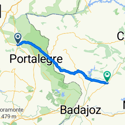
Start: Alpalhão
KM 0: After joining the IP2
3rd Category Mountain Point: Alto de Portalegre
Intermediate Sprint: Badajoz
Intermediate Sprint: Mérida
3rd Category Mountain Point: Alto de Valverde
Finish: Villanueva de la Serena
- -:--
- Duration
- 213.1 km
- Distance
- 494 m
- Ascent
- 517 m
- Descent
- ---
- Avg. speed
- ---
- Max. altitude
Route quality
Waytypes & surfaces along the route
Waytypes
Quiet road
23.4 km
(11 %)
Road
21.3 km
(10 %)
Surfaces
Paved
68.2 km
(32 %)
Unpaved
2.1 km
(1 %)
Asphalt
66.1 km
(31 %)
Paved (undefined)
2.1 km
(1 %)
Route highlights
Points of interest along the route

Point of interest after 1.6 km
Salida Oficial Tras acceder a la IP2 dirección Portalegre

Point of interest after 14.5 km
Comienza Puerto

Point of interest after 20.3 km
Alto de Portalegre P.M. 3ª Categoría

Point of interest after 88.1 km
Badajoz Sprint Especial

Point of interest after 156.4 km
Mérida Sprint Especial

Point of interest after 159.5 km
Comienza Puerto

Point of interest after 164.4 km
Alto de Valverde P.M. 3ª Categoría
Continue with Bikemap
Use, edit, or download this cycling route
You would like to ride 3ª Etapa Ibérica 2015 or customize it for your own trip? Here is what you can do with this Bikemap route:
Free features
- Save this route as favorite or in collections
- Copy & plan your own version of this route
- Split it into stages to create a multi-day tour
- Sync your route with Garmin or Wahoo
Premium features
Free trial for 3 days, or one-time payment. More about Bikemap Premium.
- Navigate this route on iOS & Android
- Export a GPX / KML file of this route
- Create your custom printout (try it for free)
- Download this route for offline navigation
Discover more Premium features.
Get Bikemap PremiumFrom our community
Other popular routes starting in Alagoa
 Alpalhao to La Roca
- Distance
- 102.7 km
- Ascent
- 684 m
- Descent
- 755 m
- Location
- Alagoa, Portalegre District, Portugal
 Flor da Rosa Vale do Peso
- Distance
- 23.1 km
- Ascent
- 261 m
- Descent
- 258 m
- Location
- Alagoa, Portalegre District, Portugal
 EN 246 - Lés a Lés (Alpalhão-Elvas)
- Distance
- 85.1 km
- Ascent
- 882 m
- Descent
- 917 m
- Location
- Alagoa, Portalegre District, Portugal
 2014 - Cáceres - Santarém - 4. Tag - Alpalhão - Abrantes
- Distance
- 66.7 km
- Ascent
- 345 m
- Descent
- 514 m
- Location
- Alagoa, Portalegre District, Portugal
 PR1 CRT Rota Histórica de Flor da Rosa
- Distance
- 27.7 km
- Ascent
- 328 m
- Descent
- 328 m
- Location
- Alagoa, Portalegre District, Portugal
![[BTT]Alpalhão-Mação](https://media.bikemap.net/routes/1249737/staticmaps/in_266d536e-00ec-48cb-8695-fe28b3f30337_400x400_bikemap-2021-3D-static.png) [BTT]Alpalhão-Mação
[BTT]Alpalhão-Mação- Distance
- 53.9 km
- Ascent
- 573 m
- Descent
- 653 m
- Location
- Alagoa, Portalegre District, Portugal
 volta estrada
- Distance
- 34 km
- Ascent
- 169 m
- Descent
- 169 m
- Location
- Alagoa, Portalegre District, Portugal
 3ª Etapa Ibérica 2015
- Distance
- 213.1 km
- Ascent
- 494 m
- Descent
- 517 m
- Location
- Alagoa, Portalegre District, Portugal
Open it in the app