
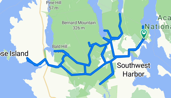

Around Mountain & 7 Bridges
- 24.1 km
- 26 m
- 22 m
- Tremont, State of Maine, United States
This route travels on about 65% dirt roads (with a short section of non-technical trail riding), and 35% pavement, and there is a short non-technical trail section. A number of these dirt roads are one lane and are out in a thick forest, with green moss making up the forest bed. It's really nice on a sunny day.
On Cape Road there are a few picnic tables near a small harbor and boat launch. There is a great view here while snacking on the Clif Bar. About 2/3rds way through is a fire road that takes you to the southernmost point. It ends at a small body of water that eventually becomes Bass Harbor. It's in the middle of nowhere. Parking it at the trail head for Flying Mtn.Quiet road
26.8 km60 %Road
7.6 km17 %Paved
5.4 km(12 %)Unpaved
17.4 km(39 %)Unpaved (undefined)
17.4 km39 %Asphalt
5.4 km12 %Undefined
21.9 km49 %Picnic table with a great view while chewing on the Clif Bar.
Free trial for 3 days, or one-time payment. More about Bikemap Premium.
Discover more Premium features.
Get Bikemap PremiumOpen it in the app


