

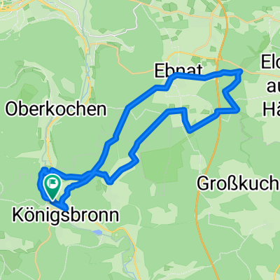
Mitwoch-Abend-Tour 07.05.08
A cycling route starting in Königsbronn, Baden-Wurttemberg, Germany.
Overview
About this route
Penka, Markus M. and I on tour
- -:--
- Duration
- 30.2 km
- Distance
- 294 m
- Ascent
- 218 m
- Descent
- ---
- Avg. speed
- 660 m
- Max. altitude
Route quality
Waytypes & surfaces along the route
Waytypes
Track
23.9 km
(79 %)
Quiet road
4.2 km
(14 %)
Surfaces
Paved
10.3 km
(34 %)
Unpaved
18.7 km
(62 %)
Gravel
18.1 km
(60 %)
Asphalt
7.6 km
(25 %)
Continue with Bikemap
Use, edit, or download this cycling route
You would like to ride Mitwoch-Abend-Tour 07.05.08 or customize it for your own trip? Here is what you can do with this Bikemap route:
Free features
- Save this route as favorite or in collections
- Copy & plan your own version of this route
- Sync your route with Garmin or Wahoo
Premium features
Free trial for 3 days, or one-time payment. More about Bikemap Premium.
- Navigate this route on iOS & Android
- Export a GPX / KML file of this route
- Create your custom printout (try it for free)
- Download this route for offline navigation
Discover more Premium features.
Get Bikemap PremiumFrom our community
Other popular routes starting in Königsbronn
 Brenz-Radrundweg_Königsbronn_Lauingen_Giengen 95km 310hm
- Distance
- 94.6 km
- Ascent
- 161 m
- Descent
- 198 m
- Location
- Königsbronn, Baden-Wurttemberg, Germany
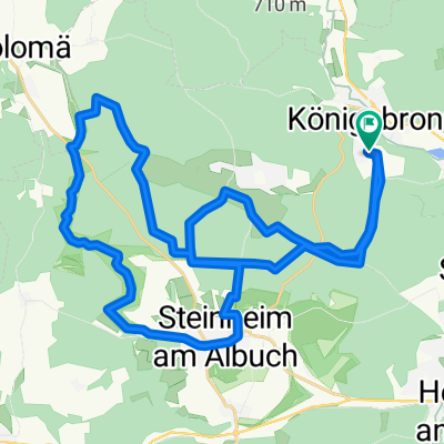
 Königsbronn, Aalbäumle, Heide
- Distance
- 33 km
- Ascent
- 612 m
- Descent
- 612 m
- Location
- Königsbronn, Baden-Wurttemberg, Germany
 Wentaltour
- Distance
- 26.8 km
- Ascent
- 372 m
- Descent
- 372 m
- Location
- Königsbronn, Baden-Wurttemberg, Germany
 Königsbronn - Wental - Steinheim - Königsbronn
- Distance
- 34.8 km
- Ascent
- 385 m
- Descent
- 356 m
- Location
- Königsbronn, Baden-Wurttemberg, Germany
 Königsbronn- Tauchenweiler -Rosenstein
- Distance
- 23.5 km
- Ascent
- 667 m
- Descent
- 487 m
- Location
- Königsbronn, Baden-Wurttemberg, Germany
 Volkmarsbergtour
- Distance
- 19.8 km
- Ascent
- 491 m
- Descent
- 372 m
- Location
- Königsbronn, Baden-Wurttemberg, Germany
 Ziegelhütte - Weiherwiesen - Volkmasberg
- Distance
- 24.2 km
- Ascent
- 377 m
- Descent
- 395 m
- Location
- Königsbronn, Baden-Wurttemberg, Germany
 Mitwoch-Abend-Tour 07.05.08
- Distance
- 30.2 km
- Ascent
- 294 m
- Descent
- 218 m
- Location
- Königsbronn, Baden-Wurttemberg, Germany
Open it in the app