Pak Gravier
- 182 km
- 984 m
- 985 m
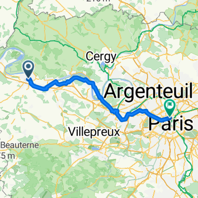
- Mantes-la-Jolie, Île-de-France Region, France
A cycling route starting in Mantes-la-Jolie, Île-de-France Region, France.
Overview
A project for a ride to Giverny museum
Route quality
Road
27.3 km
(32 %)
Quiet road
13.6 km
(16 %)
Paved
34.1 km
(40 %)
Asphalt
34.1 km
(40 %)
Undefined
51.1 km
(60 %)
Continue with Bikemap
You would like to ride Mantes-Giverny-Gisors-Chars or customize it for your own trip? Here is what you can do with this Bikemap route:
Free trial for 3 days, or one-time payment. More about Bikemap Premium.
Discover more Premium features.
Get Bikemap PremiumFrom our community
Open it in the app