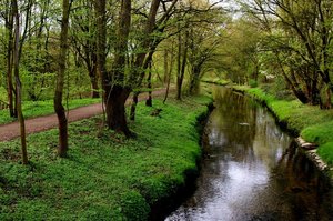
Schloss Benrath
A cycling route starting in Opladen, North Rhine-Westphalia, Germany.
Overview
About this route
Schloss Benrath liegt im südlichen Stadtteil Benrath in der nordrhein-westfälischen Landeshauptstadt Düsseldorf.
- -:--
- Duration
- 64.7 km
- Distance
- 88 m
- Ascent
- 103 m
- Descent
- ---
- Avg. speed
- ---
- Max. altitude
Route quality
Waytypes & surfaces along the route
Waytypes
Path
24.8 km
(38 %)
Quiet road
17 km
(26 %)
Surfaces
Paved
51.1 km
(79 %)
Unpaved
9.8 km
(15 %)
Asphalt
40.7 km
(63 %)
Gravel
9 km
(14 %)
Route highlights
Points of interest along the route

Point of interest after 15.4 km
Langenfeld

Photo after 21.9 km
Itter Radweg

Point of interest after 28.3 km
Schlosspark, Düsseldorf Benrath
Accommodation after 30.2 km
Gasthaus Jägerhof Urdenbacher Dorfstraße.22 40593 Düsseldorf elefon: 0211 715 916 Öffnungszeiten: Di. bis So.: 11-24 Uhr,

Point of interest after 31.6 km
Düsseldorf - Urdenbacher Altrhein

Photo after 33.4 km
Weg zur Ente!

Point of interest after 35.9 km
Baumberger Rheinterrassen Klappertorstr. 47 40789 Monheim Öffnungszeiten: Täglich 10.00-22.00 Uhr Küche durchgehend!

Point of interest after 40.2 km
Monheim am Rhein. Weg auf dem neuen Damm. Links: Das neue Überflutungsgebiet.
Continue with Bikemap
Use, edit, or download this cycling route
You would like to ride Schloss Benrath or customize it for your own trip? Here is what you can do with this Bikemap route:
Free features
- Save this route as favorite or in collections
- Copy & plan your own version of this route
- Sync your route with Garmin or Wahoo
Premium features
Free trial for 3 days, or one-time payment. More about Bikemap Premium.
- Navigate this route on iOS & Android
- Export a GPX / KML file of this route
- Create your custom printout (try it for free)
- Download this route for offline navigation
Discover more Premium features.
Get Bikemap PremiumFrom our community
Other popular routes starting in Opladen
 leverkusen - Zons - leverkusen
- Distance
- 48.3 km
- Ascent
- 99 m
- Descent
- 102 m
- Location
- Opladen, North Rhine-Westphalia, Germany
 80 km Runde Kürten Dabringhausen Hilgen
- Distance
- 82.7 km
- Ascent
- 809 m
- Descent
- 812 m
- Location
- Opladen, North Rhine-Westphalia, Germany
 Quettingen -N`höfer Allee
- Distance
- 23.4 km
- Ascent
- 32 m
- Descent
- 46 m
- Location
- Opladen, North Rhine-Westphalia, Germany
 MTB Tour Zons
- Distance
- 54.4 km
- Ascent
- 128 m
- Descent
- 129 m
- Location
- Opladen, North Rhine-Westphalia, Germany
 28.09.2013
- Distance
- 39.9 km
- Ascent
- 116 m
- Descent
- 113 m
- Location
- Opladen, North Rhine-Westphalia, Germany
 Rund um Köln 60km Jedermannrennen
- Distance
- 54.2 km
- Ascent
- 473 m
- Descent
- 471 m
- Location
- Opladen, North Rhine-Westphalia, Germany
 Klausis kleine Abendrunde
- Distance
- 20.3 km
- Ascent
- 78 m
- Descent
- 77 m
- Location
- Opladen, North Rhine-Westphalia, Germany
 Rundfahrt Leverkusen - SG Glüder - Witzhelden
- Distance
- 36.6 km
- Ascent
- 466 m
- Descent
- 424 m
- Location
- Opladen, North Rhine-Westphalia, Germany
Open it in the app


