

FP-Jahresabschlußfahrt am 18.10.2014
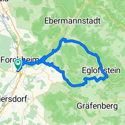
A cycling route starting in Forchheim, Bavaria, Germany.
Overview
About this route
ridden on 18.1014
Route: FO-Pommersfelden-HÖS
- -:--
- Duration
- 78.8 km
- Distance
- 383 m
- Ascent
- 385 m
- Descent
- ---
- Avg. speed
- ---
- Max. altitude

Route quality
Waytypes & surfaces along the route
Waytypes
Road
26 km
(33 %)
Quiet road
11 km
(14 %)
Surfaces
Paved
71.7 km
(91 %)
Unpaved
0.8 km
(1 %)
Asphalt
68.6 km
(87 %)
Paved (undefined)
3.2 km
(4 %)
Route highlights
Points of interest along the route

Point of interest after 0 km

Point of interest after 0 km
Treffpunkt vor Königsbad

Point of interest after 38.5 km
vor Schloß Weissenstein in Pommersfelden

Point of interest after 48.4 km
Einkehr (bei Kaffee,Eis u. Weizen) in Höchstadt

Point of interest after 48.4 km

Point of interest after 48.4 km

Point of interest after 48.4 km

Point of interest after 48.4 km

Point of interest after 50.6 km
Continue with Bikemap
Use, edit, or download this cycling route
You would like to ride FP-Jahresabschlußfahrt am 18.10.2014 or customize it for your own trip? Here is what you can do with this Bikemap route:
Free features
- Save this route as favorite or in collections
- Copy & plan your own version of this route
- Sync your route with Garmin or Wahoo
Premium features
Free trial for 3 days, or one-time payment. More about Bikemap Premium.
- Navigate this route on iOS & Android
- Export a GPX / KML file of this route
- Create your custom printout (try it for free)
- Download this route for offline navigation
Discover more Premium features.
Get Bikemap PremiumFrom our community
Other popular routes starting in Forchheim
 10th Afterwork Bicycle Tour 2025 Trubachtal Thuisbrunn
- Distance
- 50.5 km
- Ascent
- 549 m
- Descent
- 549 m
- Location
- Forchheim, Bavaria, Germany
 Abendrunde II
- Distance
- 29.4 km
- Ascent
- 274 m
- Descent
- 274 m
- Location
- Forchheim, Bavaria, Germany
 Dechsendorf
- Distance
- 35.5 km
- Ascent
- 236 m
- Descent
- 236 m
- Location
- Forchheim, Bavaria, Germany
 Forchheim - kurze Feierabendrunde
- Distance
- 20.8 km
- Ascent
- 200 m
- Descent
- 133 m
- Location
- Forchheim, Bavaria, Germany
 FP-Jahresabschlußfahrt am 18.10.2014
- Distance
- 78.8 km
- Ascent
- 383 m
- Descent
- 385 m
- Location
- Forchheim, Bavaria, Germany
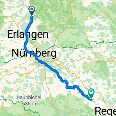 Forchheim - Lupburg
- Distance
- 117.5 km
- Ascent
- 985 m
- Descent
- 688 m
- Location
- Forchheim, Bavaria, Germany
 Von Forchheim nach Bamberg und zurück(64,8 km)
- Distance
- 64.7 km
- Ascent
- 265 m
- Descent
- 263 m
- Location
- Forchheim, Bavaria, Germany
 Forchheimer Radrundweg FO 2
- Distance
- 44.6 km
- Ascent
- 398 m
- Descent
- 398 m
- Location
- Forchheim, Bavaria, Germany
Open it in the app