


Runde um Gaißa und Donau
- 32 km
- 426 m
- 425 m
- Tiefenbach, Bavaria, Germany
A cycling route starting in Tiefenbach, Bavaria, Germany.
Overview
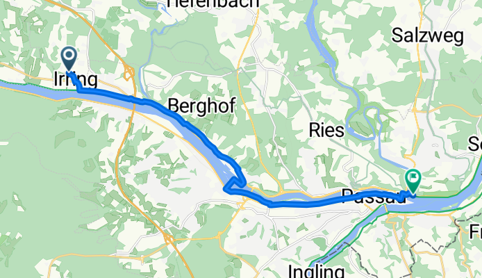
Danube Cycle Path. Irring - Passau 13 km. Stage 20, km 587 to km 600
created this 11 years ago
Route quality
Cycleway
4.2 km
(33 %)
Quiet road
2.3 km
(18 %)
Paved
8.3 km
(66 %)
Unpaved
2.9 km
(23 %)
Asphalt
8.1 km
(64 %)
Loose gravel
2.9 km
(23 %)
Continue with Bikemap
You would like to ride 20 Irring - Passau or customize it for your own trip? Here is what you can do with this Bikemap route:
Free trial for 3 days, or one-time payment. More about Bikemap Premium.
Discover more Premium features.
Get Bikemap PremiumFrom our community
Open it in the app


