

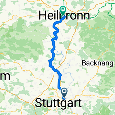
stuttgart (südost-südwest-city)
A cycling route starting in Stuttgart-Ost, Baden-Wurttemberg, Germany.
Overview
About this route
asphalt about 75%, a few short, steep climbs
- -:--
- Duration
- 33 km
- Distance
- 516 m
- Ascent
- 516 m
- Descent
- ---
- Avg. speed
- ---
- Max. altitude
Route quality
Waytypes & surfaces along the route
Waytypes
Quiet road
15.2 km
(46 %)
Track
9.6 km
(29 %)
Surfaces
Paved
25.8 km
(78 %)
Unpaved
5.3 km
(16 %)
Asphalt
25.4 km
(77 %)
Loose gravel
2.3 km
(7 %)
Continue with Bikemap
Use, edit, or download this cycling route
You would like to ride stuttgart (südost-südwest-city) or customize it for your own trip? Here is what you can do with this Bikemap route:
Free features
- Save this route as favorite or in collections
- Copy & plan your own version of this route
- Sync your route with Garmin or Wahoo
Premium features
Free trial for 3 days, or one-time payment. More about Bikemap Premium.
- Navigate this route on iOS & Android
- Export a GPX / KML file of this route
- Create your custom printout (try it for free)
- Download this route for offline navigation
Discover more Premium features.
Get Bikemap PremiumFrom our community
Other popular routes starting in Stuttgart-Ost
 SonntagsfahrerJubitour 2008
- Distance
- 15 km
- Ascent
- 380 m
- Descent
- 378 m
- Location
- Stuttgart-Ost, Baden-Wurttemberg, Germany
 Bad Canstatt - Heilbronn
- Distance
- 58.1 km
- Ascent
- 545 m
- Descent
- 612 m
- Location
- Stuttgart-Ost, Baden-Wurttemberg, Germany
 Feierabendrunde
- Distance
- 39.1 km
- Ascent
- 494 m
- Descent
- 466 m
- Location
- Stuttgart-Ost, Baden-Wurttemberg, Germany
 Tour 30. Juli 2025 - Variante neu
- Distance
- 214.6 km
- Ascent
- 3,122 m
- Descent
- 3,122 m
- Location
- Stuttgart-Ost, Baden-Wurttemberg, Germany
 Stuttgart-Remstal-Rundfahrt
- Distance
- 73.8 km
- Ascent
- 732 m
- Descent
- 713 m
- Location
- Stuttgart-Ost, Baden-Wurttemberg, Germany
 Rössleweg
- Distance
- 56.2 km
- Ascent
- 778 m
- Descent
- 778 m
- Location
- Stuttgart-Ost, Baden-Wurttemberg, Germany
 siebenmühlental
- Distance
- 49.2 km
- Ascent
- 513 m
- Descent
- 508 m
- Location
- Stuttgart-Ost, Baden-Wurttemberg, Germany
 rotenberg - lederberg - zollberg
- Distance
- 40.6 km
- Ascent
- 647 m
- Descent
- 625 m
- Location
- Stuttgart-Ost, Baden-Wurttemberg, Germany
Open it in the app