

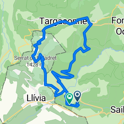
Descente Train Jaune
A cycling route starting in Osséja, Occitanie, France.
Overview
About this route
Train Jaune descent
- -:--
- Duration
- 24.5 km
- Distance
- 601 m
- Ascent
- 1,504 m
- Descent
- ---
- Avg. speed
- ---
- Max. altitude

Continue with Bikemap
Use, edit, or download this cycling route
You would like to ride Descente Train Jaune or customize it for your own trip? Here is what you can do with this Bikemap route:
Free features
- Save this route as favorite or in collections
- Copy & plan your own version of this route
- Sync your route with Garmin or Wahoo
Premium features
Free trial for 3 days, or one-time payment. More about Bikemap Premium.
- Navigate this route on iOS & Android
- Export a GPX / KML file of this route
- Create your custom printout (try it for free)
- Download this route for offline navigation
Discover more Premium features.
Get Bikemap PremiumFrom our community
Other popular routes starting in Osséja
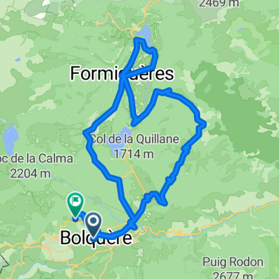 Route in Bolquère
- Distance
- 63 km
- Ascent
- 1,546 m
- Descent
- 1,386 m
- Location
- Osséja, Occitanie, France
 De Rue d'Espagne 26, Palau-de-Cerdagne a Route sans nom, Osséja
- Distance
- 9.8 km
- Ascent
- 934 m
- Descent
- 25 m
- Location
- Osséja, Occitanie, France
 Ariège Est 21
- Distance
- 518.4 km
- Ascent
- 8,555 m
- Descent
- 9,036 m
- Location
- Osséja, Occitanie, France
 Tour villages SUD
- Distance
- 45.2 km
- Ascent
- 1,129 m
- Descent
- 1,129 m
- Location
- Osséja, Occitanie, France
 Perche,Les Angles, Creu , LLose
- Distance
- 46.4 km
- Ascent
- 1,028 m
- Descent
- 1,023 m
- Location
- Osséja, Occitanie, France
 TDFEtape 3
- Distance
- 92 km
- Ascent
- 1,295 m
- Descent
- 2,335 m
- Location
- Osséja, Occitanie, France
 Estavar à Camí del Sègre, Estavar
- Distance
- 19.7 km
- Ascent
- 553 m
- Descent
- 557 m
- Location
- Osséja, Occitanie, France
 Descente Train Jaune
- Distance
- 24.5 km
- Ascent
- 601 m
- Descent
- 1,504 m
- Location
- Osséja, Occitanie, France
Open it in the app