

MTB BESKID MAŁY
A cycling route starting in Czernichów, Silesian Voivodeship, Poland.
Overview
About this route
Start: Czernichów
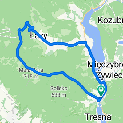
on the green route to Tresną. on the yellow route to Solisko. on the red route to Czupel. on the blue route to Magurkę Wilkowicką. Gaiki, we switch to the red route. Hrobacza Łąka. descend to Międzybrodzia. on the red route to Żar, Kiczera. on the Cisowy pass we switch to the blue route. Jaworzyna, Kościelec and descent on the blue route to Czernichów- -:--
- Duration
- 38.8 km
- Distance
- 1,452 m
- Ascent
- 1,452 m
- Descent
- ---
- Avg. speed
- ---
- Max. altitude

Continue with Bikemap
Use, edit, or download this cycling route
You would like to ride MTB BESKID MAŁY or customize it for your own trip? Here is what you can do with this Bikemap route:
Free features
- Save this route as favorite or in collections
- Copy & plan your own version of this route
- Sync your route with Garmin or Wahoo
Premium features
Free trial for 3 days, or one-time payment. More about Bikemap Premium.
- Navigate this route on iOS & Android
- Export a GPX / KML file of this route
- Create your custom printout (try it for free)
- Download this route for offline navigation
Discover more Premium features.
Get Bikemap PremiumFrom our community
Other popular routes starting in Czernichów
 2020-12-16 on AllTrails
- Distance
- 43.8 km
- Ascent
- 1,888 m
- Descent
- 1,888 m
- Location
- Czernichów, Silesian Voivodeship, Poland
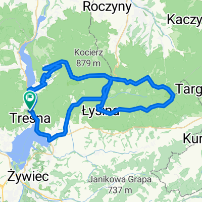
 *AMTB Wokoło Międzybrodzia 04.06.2011
- Distance
- 38.8 km
- Ascent
- 1,499 m
- Descent
- 1,499 m
- Location
- Czernichów, Silesian Voivodeship, Poland
 Góra Żar
- Distance
- 12.3 km
- Ascent
- 494 m
- Descent
- 496 m
- Location
- Czernichów, Silesian Voivodeship, Poland
 *AMTB Czupel-Magurka Wil. 09.04.2011
- Distance
- 20 km
- Ascent
- 689 m
- Descent
- 690 m
- Location
- Czernichów, Silesian Voivodeship, Poland
 *AMTB 2011-03-27 Łamana Skała
- Distance
- 52.8 km
- Ascent
- 1,221 m
- Descent
- 1,221 m
- Location
- Czernichów, Silesian Voivodeship, Poland
 Czernichów, Chrobacza Łąka, Przegibek, Magurka, Czupel, Czernichów
- Distance
- 29.5 km
- Ascent
- 988 m
- Descent
- 988 m
- Location
- Czernichów, Silesian Voivodeship, Poland
 MTB BESKID MAŁY
- Distance
- 38.8 km
- Ascent
- 1,452 m
- Descent
- 1,452 m
- Location
- Czernichów, Silesian Voivodeship, Poland
 Międz.Żyw.- Szczyrk-Brenna-BB -Międz.Żywieckie
- Distance
- 75.6 km
- Ascent
- 890 m
- Descent
- 905 m
- Location
- Czernichów, Silesian Voivodeship, Poland
Open it in the app