A3-Poprzez pagórki.
A cycling route starting in Krosno, Subcarpathian Voivodeship, Poland.
Overview
About this route
Route to Rymanów, then to Klimkówka and shortcut to Iwonicz Zdrój. Then through the hills to Lubatowa, Równy and around Bórka. Interesting with some tougher stages in the churned mud.
- -:--
- Duration
- 50 km
- Distance
- 404 m
- Ascent
- 401 m
- Descent
- ---
- Avg. speed
- ---
- Max. altitude
Route highlights
Points of interest along the route

Point of interest after 8 km
Jesienna droga

Point of interest after 8.9 km

Point of interest after 9.2 km
Farma

Point of interest after 12.1 km

Point of interest after 12.8 km
W oddali...

Point of interest after 21.8 km
Klimkówka - stary kościół.

Point of interest after 27.7 km
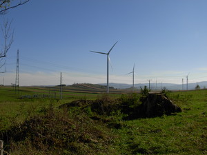
Pagórki - czyli widok z Iwonickiego szlaku na przeciwległe zbocze w Lubatowej (i jeszcze dalej),

Point of interest after 34.1 km
Kładka przez Jasiołkę.

Point of interest after 34.4 km
Widok na lasy Bóbrki.
Continue with Bikemap
Use, edit, or download this cycling route
You would like to ride A3-Poprzez pagórki. or customize it for your own trip? Here is what you can do with this Bikemap route:
Free features
- Save this route as favorite or in collections
- Copy & plan your own version of this route
- Sync your route with Garmin or Wahoo
Premium features
Free trial for 3 days, or one-time payment. More about Bikemap Premium.
- Navigate this route on iOS & Android
- Export a GPX / KML file of this route
- Create your custom printout (try it for free)
- Download this route for offline navigation
Discover more Premium features.
Get Bikemap PremiumFrom our community
Other popular routes starting in Krosno
 A2-Ku Bóbrce
- Distance
- 29.7 km
- Ascent
- 180 m
- Descent
- 180 m
- Location
- Krosno, Subcarpathian Voivodeship, Poland
 A3-Poprzez pagórki.
- Distance
- 50 km
- Ascent
- 404 m
- Descent
- 401 m
- Location
- Krosno, Subcarpathian Voivodeship, Poland
 Krosno - Nowy Żmigród - Krosno
- Distance
- 55.4 km
- Ascent
- 383 m
- Descent
- 383 m
- Location
- Krosno, Subcarpathian Voivodeship, Poland
 A4-Niedokończony ślad.
- Distance
- 17.1 km
- Ascent
- 323 m
- Descent
- 335 m
- Location
- Krosno, Subcarpathian Voivodeship, Poland
 A1-Pętla wokół Krosna
- Distance
- 50.7 km
- Ascent
- 498 m
- Descent
- 498 m
- Location
- Krosno, Subcarpathian Voivodeship, Poland
 Dukla Myscowa Polany Dukla
- Distance
- 75.7 km
- Ascent
- 556 m
- Descent
- 565 m
- Location
- Krosno, Subcarpathian Voivodeship, Poland
 A5-Pętla Mniszków!
- Distance
- 54.2 km
- Ascent
- 350 m
- Descent
- 342 m
- Location
- Krosno, Subcarpathian Voivodeship, Poland
 2016_Lasy Kombo,
- Distance
- 35.4 km
- Ascent
- 471 m
- Descent
- 476 m
- Location
- Krosno, Subcarpathian Voivodeship, Poland
Open it in the app

