

Sotos
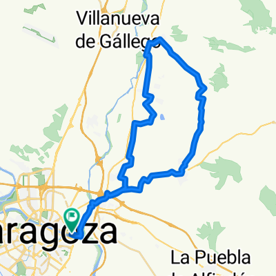
A cycling route starting in Zaragoza, Aragon, Spain.
Overview
About this route
Posiblemente, esta ruta es la más interesante y divertida de cuantos recorridos urbanos puedan realizarse por Zaragoza. Nos adentramos en el soto del meandro de Ranillas, la desembocadura del Río Gállego y el soto de Cantalobos, el corazón de un bosque de ribera en el que tendremos que abrirnos paso sorteando todo tipo de obstáculos que aparecerán en nuestro camino. Atrévete y disfruta de un entorno natural espectacular muy cerca de casa.
- -:--
- Duration
- 37.1 km
- Distance
- 90 m
- Ascent
- 89 m
- Descent
- ---
- Avg. speed
- ---
- Max. altitude

Route quality
Waytypes & surfaces along the route
Waytypes
Track
11.3 km
(31 %)
Cycleway
9.9 km
(27 %)
Surfaces
Paved
15.1 km
(41 %)
Unpaved
0.5 km
(1 %)
Asphalt
7 km
(19 %)
Concrete
4.3 km
(12 %)
Continue with Bikemap
Use, edit, or download this cycling route
You would like to ride Sotos or customize it for your own trip? Here is what you can do with this Bikemap route:
Free features
- Save this route as favorite or in collections
- Copy & plan your own version of this route
- Sync your route with Garmin or Wahoo
Premium features
Free trial for 3 days, or one-time payment. More about Bikemap Premium.
- Navigate this route on iOS & Android
- Export a GPX / KML file of this route
- Create your custom printout (try it for free)
- Download this route for offline navigation
Discover more Premium features.
Get Bikemap PremiumFrom our community
Other popular routes starting in Zaragoza
 Zaragoza to Lecinena loop (plan)
- Distance
- 65.7 km
- Ascent
- 359 m
- Descent
- 351 m
- Location
- Zaragoza, Aragon, Spain
 Azud de Urdán
- Distance
- 27 km
- Ascent
- 64 m
- Descent
- 66 m
- Location
- Zaragoza, Aragon, Spain
 Sotos
Sotos- Distance
- 37.1 km
- Ascent
- 90 m
- Descent
- 89 m
- Location
- Zaragoza, Aragon, Spain
 Zaragoza Galachos Juslibol
- Distance
- 28.3 km
- Ascent
- 51 m
- Descent
- 58 m
- Location
- Zaragoza, Aragon, Spain
 Almuerzo en Peñaflor
- Distance
- 40 km
- Ascent
- 118 m
- Descent
- 116 m
- Location
- Zaragoza, Aragon, Spain
 Parque Tío Jorge - Anillo Verde - Parque Tío Jorge
- Distance
- 31.9 km
- Ascent
- 128 m
- Descent
- 126 m
- Location
- Zaragoza, Aragon, Spain
 cvcvcv
- Distance
- 15.3 km
- Ascent
- 100 m
- Descent
- 104 m
- Location
- Zaragoza, Aragon, Spain
 Ruta EBRO 2011 - ETAPA 15 - DOMINGO 24 JULIO - ZARAGOZA - LA PUEBLA DE ALFIDEN - VILLAFRANCA DE EBRO - OSERA DE EBRO - PINA DE EBRO - 48 KM
- Distance
- 48.4 km
- Ascent
- 105 m
- Descent
- 160 m
- Location
- Zaragoza, Aragon, Spain
Open it in the app