

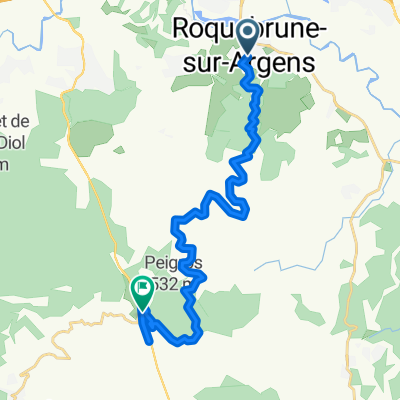
ROQUEBRUNE - Canton de Palayson - Niveau 1
A cycling route starting in Roquebrune-sur-Argens, Provence-Alpes-Côte d'Azur Region, France.
Overview
About this route
This discovery circuit allows you to take a small tour of the state forest combining singletrack, wide gravel trail, and ancient Roman road. You will find cork oak and orchids. Enjoy this natural area classified as a Natura 2000 site and managed by the National Forestry Office.
- -:--
- Duration
- 4.8 km
- Distance
- 52 m
- Ascent
- 52 m
- Descent
- ---
- Avg. speed
- ---
- Max. altitude
Continue with Bikemap
Use, edit, or download this cycling route
You would like to ride ROQUEBRUNE - Canton de Palayson - Niveau 1 or customize it for your own trip? Here is what you can do with this Bikemap route:
Free features
- Save this route as favorite or in collections
- Copy & plan your own version of this route
- Sync your route with Garmin or Wahoo
Premium features
Free trial for 3 days, or one-time payment. More about Bikemap Premium.
- Navigate this route on iOS & Android
- Export a GPX / KML file of this route
- Create your custom printout (try it for free)
- Download this route for offline navigation
Discover more Premium features.
Get Bikemap PremiumFrom our community
Other popular routes starting in Roquebrune-sur-Argens
 RoquebruneNW
- Distance
- 47 km
- Ascent
- 491 m
- Descent
- 492 m
- Location
- Roquebrune-sur-Argens, Provence-Alpes-Côte d'Azur Region, France
 ROQUEBRUNE - Palayson - niveau 3
- Distance
- 19.1 km
- Ascent
- 235 m
- Descent
- 230 m
- Location
- Roquebrune-sur-Argens, Provence-Alpes-Côte d'Azur Region, France
 ROQUEBRUNE N°3
- Distance
- 69.5 km
- Ascent
- 811 m
- Descent
- 813 m
- Location
- Roquebrune-sur-Argens, Provence-Alpes-Côte d'Azur Region, France
 Rue de l'Hospice nach Sainte-Maxime
- Distance
- 21.5 km
- Ascent
- 1,231 m
- Descent
- 1,040 m
- Location
- Roquebrune-sur-Argens, Provence-Alpes-Côte d'Azur Region, France
 LB-RsA-LM-BeF-Fr-LB
- Distance
- 57.1 km
- Ascent
- 422 m
- Descent
- 425 m
- Location
- Roquebrune-sur-Argens, Provence-Alpes-Côte d'Azur Region, France
 83 E Roquebrune Sur Argens V2.2 43K 1700Mt
- Distance
- 38.4 km
- Ascent
- 1,603 m
- Descent
- 1,601 m
- Location
- Roquebrune-sur-Argens, Provence-Alpes-Côte d'Azur Region, France
 67/370_Lac-Antibes-flat_rt
- Distance
- 67 km
- Ascent
- 226 m
- Descent
- 230 m
- Location
- Roquebrune-sur-Argens, Provence-Alpes-Côte d'Azur Region, France
 ROQUEBRUNE - Palayson - niveau 2
- Distance
- 12 km
- Ascent
- 131 m
- Descent
- 128 m
- Location
- Roquebrune-sur-Argens, Provence-Alpes-Côte d'Azur Region, France
Open it in the app