

Schlusstour Senectute 28-10-2014
A cycling route starting in Reinach, Canton of Aargau, Switzerland.
Overview
About this route
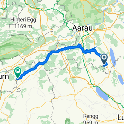
Reinach - Gontenschwil - Schlierbach - Krumbach - Radio transmitter - Beromünster - Wittwil - Schwarzenbach - Menziken
- -:--
- Duration
- 34.2 km
- Distance
- 597 m
- Ascent
- 592 m
- Descent
- ---
- Avg. speed
- ---
- Max. altitude

Route quality
Waytypes & surfaces along the route
Waytypes
Quiet road
22.6 km
(66 %)
Road
4.5 km
(13 %)
Surfaces
Paved
13 km
(38 %)
Unpaved
5.1 km
(15 %)
Asphalt
13 km
(38 %)
Gravel
3.8 km
(11 %)
Continue with Bikemap
Use, edit, or download this cycling route
You would like to ride Schlusstour Senectute 28-10-2014 or customize it for your own trip? Here is what you can do with this Bikemap route:
Free features
- Save this route as favorite or in collections
- Copy & plan your own version of this route
- Sync your route with Garmin or Wahoo
Premium features
Free trial for 3 days, or one-time payment. More about Bikemap Premium.
- Navigate this route on iOS & Android
- Export a GPX / KML file of this route
- Create your custom printout (try it for free)
- Download this route for offline navigation
Discover more Premium features.
Get Bikemap PremiumFrom our community
Other popular routes starting in Reinach
 Slow Up 2,5h
- Distance
- 33.3 km
- Ascent
- 206 m
- Descent
- 207 m
- Location
- Reinach, Canton of Aargau, Switzerland
 Einlochtour/Tannberg/Buttenberg/Kistenpass CLONED FROM ROUTE 1335167
- Distance
- 39.5 km
- Ascent
- 742 m
- Descent
- 742 m
- Location
- Reinach, Canton of Aargau, Switzerland
 Schlusstour Senectute 28-10-2014
- Distance
- 34.2 km
- Ascent
- 597 m
- Descent
- 592 m
- Location
- Reinach, Canton of Aargau, Switzerland
 Mosen-Ermensee-Sträflinge-Herrlisberg-Beromünstet-Rickenbach-Bohler-Gontenschwil-Moos-Beinwil am See
- Distance
- 30.5 km
- Ascent
- 455 m
- Descent
- 455 m
- Location
- Reinach, Canton of Aargau, Switzerland
 Homberg rauf und runter.....
- Distance
- 1.7 km
- Ascent
- 82 m
- Descent
- 6 m
- Location
- Reinach, Canton of Aargau, Switzerland
 Vordere Bergstrasse 19, Reinach AG nach Inkwilstrasse 13, Röthenbach Herzogenbuchsee
- Distance
- 55.6 km
- Ascent
- 365 m
- Descent
- 462 m
- Location
- Reinach, Canton of Aargau, Switzerland
 Rund um den Hallwilersee
- Distance
- 23.4 km
- Ascent
- 149 m
- Descent
- 217 m
- Location
- Reinach, Canton of Aargau, Switzerland
 Aarau
Aarau- Distance
- 31.8 km
- Ascent
- 334 m
- Descent
- 467 m
- Location
- Reinach, Canton of Aargau, Switzerland
Open it in the app