

Cafe´Christel - Ho Chi Minh-Pfad - Wahner Heide
A cycling route starting in Stoßdorf, North Rhine-Westphalia, Germany.
Overview
About this route
Sehr schöne Tour, viel Wald, kaum Asphalt und konditionell nicht sehr anspruchsvoll.
Der Ho-Chi Minh- Pfad erfordert ein wenig technisches Geschick....aber man kann ja auch absteigen...;-)
(cloned from route 988329)
- -:--
- Duration
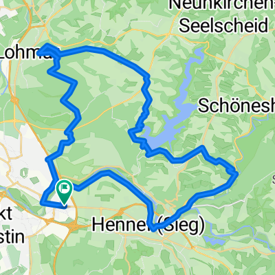
- 28 km
- Distance
- 242 m
- Ascent
- 242 m
- Descent
- ---
- Avg. speed
- ---
- Avg. speed
Continue with Bikemap
Use, edit, or download this cycling route
You would like to ride Cafe´Christel - Ho Chi Minh-Pfad - Wahner Heide or customize it for your own trip? Here is what you can do with this Bikemap route:
Free features
- Save this route as favorite or in collections
- Copy & plan your own version of this route
- Sync your route with Garmin or Wahoo
Premium features
Free trial for 3 days, or one-time payment. More about Bikemap Premium.
- Navigate this route on iOS & Android
- Export a GPX / KML file of this route
- Create your custom printout (try it for free)
- Download this route for offline navigation
Discover more Premium features.
Get Bikemap PremiumFrom our community
Other popular routes starting in Stoßdorf
 Radrunde durch Siegburg
- Distance
- 18.8 km
- Ascent
- 240 m
- Descent
- 240 m
- Location
- Stoßdorf, North Rhine-Westphalia, Germany
 Siegburg-Rheinaue-Westerwald-Runde
- Distance
- 128.3 km
- Ascent
- 1,326 m
- Descent
- 1,254 m
- Location
- Stoßdorf, North Rhine-Westphalia, Germany
 Lohmar_HohChiMinhTrail
- Distance
- 3.8 km
- Ascent
- 4 m
- Descent
- 55 m
- Location
- Stoßdorf, North Rhine-Westphalia, Germany
 Bröltal-Talsperre-Lohmar-Wald-Runde Ski&Bike
- Distance
- 37.2 km
- Ascent
- 351 m
- Descent
- 351 m
- Location
- Stoßdorf, North Rhine-Westphalia, Germany
 Happerschoß-Todesberg-Kettensägenfrau
- Distance
- 26.6 km
- Ascent
- 383 m
- Descent
- 383 m
- Location
- Stoßdorf, North Rhine-Westphalia, Germany
 Sieg-Rhein Oberdollendorf Runde Bike&Ski
- Distance
- 46.4 km
- Ascent
- 212 m
- Descent
- 155 m
- Location
- Stoßdorf, North Rhine-Westphalia, Germany
 Lohmar-Talsperren Runde 37KM
- Distance
- 37 km
- Ascent
- 515 m
- Descent
- 506 m
- Location
- Stoßdorf, North Rhine-Westphalia, Germany
 Cafe´Christel - Ho Chi Minh-Pfad - Wahner Heide
- Distance
- 28 km
- Ascent
- 242 m
- Descent
- 242 m
- Location
- Stoßdorf, North Rhine-Westphalia, Germany
Open it in the app