Maneciu-Vf Lui Crai
A cycling route starting in Măneciu-Ungureni, Prahova, Romania.
Overview
About this route
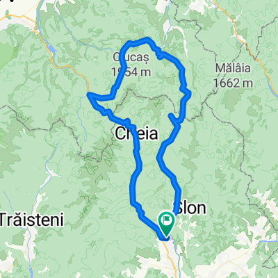
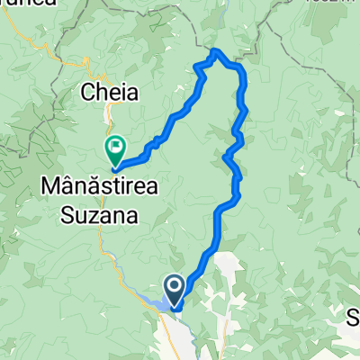
Begin at the crown of the Maneciu Dam on the road that rises to the right. Superb views along the entire route. At km 5, turn right (the road to the left descends to Telejenel), and at km 7, turn left (the road to the right descends to Slon).
- -:--
- Duration
- 15.4 km
- Distance
- 936 m
- Ascent
- 60 m
- Descent
- ---
- Avg. speed
- ---
- Max. altitude
Route quality
Waytypes & surfaces along the route
Waytypes
Quiet road
10.6 km
(69 %)
Track
4.8 km
(31 %)
Surfaces
Unpaved
15.2 km
(99 %)
Ground
8.2 km
(53 %)
Loose gravel
5.4 km
(35 %)
Continue with Bikemap
Use, edit, or download this cycling route
You would like to ride Maneciu-Vf Lui Crai or customize it for your own trip? Here is what you can do with this Bikemap route:
Free features
- Save this route as favorite or in collections
- Copy & plan your own version of this route
- Sync your route with Garmin or Wahoo
Premium features
Free trial for 3 days, or one-time payment. More about Bikemap Premium.
- Navigate this route on iOS & Android
- Export a GPX / KML file of this route
- Create your custom printout (try it for free)
- Download this route for offline navigation
Discover more Premium features.
Get Bikemap PremiumFrom our community
Other popular routes starting in Măneciu-Ungureni
- Maneciu, catre Tabla Butii, Valea Stinii, Cheia, Maneciu
- Distance
- 55.6 km
- Ascent
- 1,169 m
- Descent
- 1,169 m
- Location
- Măneciu-Ungureni, Prahova, Romania
- Creasta Muntilor Tataru
- Distance
- 49.1 km
- Ascent
- 1,095 m
- Descent
- 1,090 m
- Location
- Măneciu-Ungureni, Prahova, Romania
- Cheia MTB Challenge 2014
- Distance
- 49.8 km
- Ascent
- 1,121 m
- Descent
- 1,121 m
- Location
- Măneciu-Ungureni, Prahova, Romania
- Maneciu-lacul Vulturilor-Crasna
- Distance
- 50.1 km
- Ascent
- 1,302 m
- Descent
- 1,209 m
- Location
- Măneciu-Ungureni, Prahova, Romania
- Maneciu - Pasul Boncuta - Maneciu CLONED FROM ROUTE 63456
- Distance
- 35.1 km
- Ascent
- 595 m
- Descent
- 587 m
- Location
- Măneciu-Ungureni, Prahova, Romania
- Tabla Butii
- Distance
- 47.7 km
- Ascent
- 1,120 m
- Descent
- 1,120 m
- Location
- Măneciu-Ungureni, Prahova, Romania
- Traseul Muntilor Tataru
- Distance
- 47.6 km
- Ascent
- 1,168 m
- Descent
- 926 m
- Location
- Măneciu-Ungureni, Prahova, Romania
- Grohotis - Ciucas
- Distance
- 90 km
- Ascent
- 2,031 m
- Descent
- 2,031 m
- Location
- Măneciu-Ungureni, Prahova, Romania
Open it in the app