

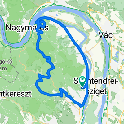
Urak asztala
A cycling route starting in Leányfalu, Pest County, Hungary.
Overview
About this route
jó nagy tévedés volt a kitérő
- -:--
- Duration
- 23.2 km
- Distance
- 562 m
- Ascent
- 562 m
- Descent
- ---
- Avg. speed
- ---
- Max. altitude

Continue with Bikemap
Use, edit, or download this cycling route
You would like to ride Urak asztala or customize it for your own trip? Here is what you can do with this Bikemap route:
Free features
- Save this route as favorite or in collections
- Copy & plan your own version of this route
- Sync your route with Garmin or Wahoo
Premium features
Free trial for 3 days, or one-time payment. More about Bikemap Premium.
- Navigate this route on iOS & Android
- Export a GPX / KML file of this route
- Create your custom printout (try it for free)
- Download this route for offline navigation
Discover more Premium features.
Get Bikemap PremiumFrom our community
Other popular routes starting in Leányfalu
 Visegrád-panoráma-Paprét-Kisrigó-Skanzen
- Distance
- 55.1 km
- Ascent
- 795 m
- Descent
- 809 m
- Location
- Leányfalu, Pest County, Hungary
 Dombalja utca 9, Szentendre to Dombalja utca 7, Szentendre
- Distance
- 19.8 km
- Ascent
- 600 m
- Descent
- 595 m
- Location
- Leányfalu, Pest County, Hungary
 Pap rét hosszú
- Distance
- 17.2 km
- Ascent
- 358 m
- Descent
- 405 m
- Location
- Leányfalu, Pest County, Hungary
 Pilis 8-as
- Distance
- 78.3 km
- Ascent
- 1,280 m
- Descent
- 1,283 m
- Location
- Leányfalu, Pest County, Hungary
 Pilis kiskör
- Distance
- 88.1 km
- Ascent
- 1,199 m
- Descent
- 1,198 m
- Location
- Leányfalu, Pest County, Hungary
 kaland körtúra
- Distance
- 34.7 km
- Ascent
- 465 m
- Descent
- 465 m
- Location
- Leányfalu, Pest County, Hungary
 Sztaravoda_Visegrad
- Distance
- 13.8 km
- Ascent
- 354 m
- Descent
- 408 m
- Location
- Leányfalu, Pest County, Hungary
 Unnamed Road, Dunabogdány to Fő tér 12, Szentendre
- Distance
- 11.7 km
- Ascent
- 76 m
- Descent
- 425 m
- Location
- Leányfalu, Pest County, Hungary
Open it in the app