Vriezenveen/ Baldermoor/ Ootmarsum
A cycling route starting in Vriezenveen, Overijssel, The Netherlands.
Overview
About this route
Rondje Baldermoor/Getelomoor
- -:--
- Duration
- 45.9 km
- Distance
- 116 m
- Ascent
- 66 m
- Descent
- ---
- Avg. speed
- ---
- Max. altitude
Route quality
Waytypes & surfaces along the route
Waytypes
Quiet road
20.2 km
(44 %)
Road
18.8 km
(41 %)
Surfaces
Paved
33 km
(72 %)
Unpaved
0.5 km
(1 %)
Asphalt
31.7 km
(69 %)
Concrete
0.9 km
(2 %)
Continue with Bikemap
Use, edit, or download this cycling route
You would like to ride Vriezenveen/ Baldermoor/ Ootmarsum or customize it for your own trip? Here is what you can do with this Bikemap route:
Free features
- Save this route as favorite or in collections
- Copy & plan your own version of this route
- Sync your route with Garmin or Wahoo
Premium features
Free trial for 3 days, or one-time payment. More about Bikemap Premium.
- Navigate this route on iOS & Android
- Export a GPX / KML file of this route
- Create your custom printout (try it for free)
- Download this route for offline navigation
Discover more Premium features.
Get Bikemap PremiumFrom our community
Other popular routes starting in Vriezenveen
- 22 km rond pollen
- Distance
- 22.2 km
- Ascent
- 0 m
- Descent
- 0 m
- Location
- Vriezenveen, Overijssel, The Netherlands
- vriezenveen holterberg route
- Distance
- 68.3 km
- Ascent
- 165 m
- Descent
- 165 m
- Location
- Vriezenveen, Overijssel, The Netherlands
- Vriezenveen/ Baldermoor/ Ootmarsum
- Distance
- 45.9 km
- Ascent
- 116 m
- Descent
- 66 m
- Location
- Vriezenveen, Overijssel, The Netherlands
- vriezenveen-getelo route 44 km
- Distance
- 44 km
- Ascent
- 51 m
- Descent
- 50 m
- Location
- Vriezenveen, Overijssel, The Netherlands
- Tankenberg via saasveld
- Distance
- 60.5 km
- Ascent
- 89 m
- Descent
- 90 m
- Location
- Vriezenveen, Overijssel, The Netherlands
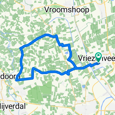
- vriezenveen -balderhaar route
- Distance
- 38.4 km
- Ascent
- 27 m
- Descent
- 27 m
- Location
- Vriezenveen, Overijssel, The Netherlands
- vriezenveen- wielen route
- Distance
- 40.8 km
- Ascent
- 55 m
- Descent
- 54 m
- Location
- Vriezenveen, Overijssel, The Netherlands
- vriezenveen- hellendoorn-holterberg route 69km
- Distance
- 68.4 km
- Ascent
- 157 m
- Descent
- 157 m
- Location
- Vriezenveen, Overijssel, The Netherlands
Open it in the app