

Mittwoch
Geopark Tannenbusch
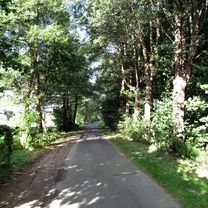
A cycling route starting in Altstadt Nord, North Rhine-Westphalia, Germany.
Overview
About this route
Im Jahre 1980 wurde der Geopark als geologischer Lehrpfad von der Schutzgemeinschaft Deutscher Wald in der Form einer naturnah gestalteten Anlage eröffnet. Konzipiert als ein kleiner Rundweg zeigt der Geopark wesentliche, landschaftsprägende Gesteine.
- -:--
- Duration
- 62.2 km
- Distance
- 58 m
- Ascent
- 62 m
- Descent
- ---
- Avg. speed
- ---
- Max. altitude

Part of
3 stages
Route quality
Waytypes & surfaces along the route
Waytypes
Path
20.9 km
(34 %)
Quiet road
14 km
(22 %)
Surfaces
Paved
43.6 km
(70 %)
Unpaved
5.4 km
(9 %)
Asphalt
34.9 km
(56 %)
Paving stones
6.4 km
(10 %)
Route highlights
Points of interest along the route

Accommodation after 28.2 km
Waldgasthaus Tannenbusch Im Tannenbusch 2 41540 Dormagen Tel (02133) 8 06 06 Öffnungszeiten in den Wintermonaten: Täglich von 12.00 - 23.00 Uhr

Point of interest after 41.3 km
Taverne Worringer Hof Hackhauser Weg 74 50769 Köln Telefon: 0221 7886957 Samstag - Sonn- und Feiertage: 12:00 - 24:00 Uhr
Continue with Bikemap
Use, edit, or download this cycling route
You would like to ride Geopark Tannenbusch or customize it for your own trip? Here is what you can do with this Bikemap route:
Free features
- Save this route as favorite or in collections
- Copy & plan your own version of this route
- Sync your route with Garmin or Wahoo
Premium features
Free trial for 3 days, or one-time payment. More about Bikemap Premium.
- Navigate this route on iOS & Android
- Export a GPX / KML file of this route
- Create your custom printout (try it for free)
- Download this route for offline navigation
Discover more Premium features.
Get Bikemap PremiumFrom our community
Other popular routes starting in Altstadt Nord
 Geopark Tannenbusch
- Distance
- 62.2 km
- Ascent
- 58 m
- Descent
- 62 m
- Location
- Altstadt Nord, North Rhine-Westphalia, Germany
 Breite - A4 - Deutz - Zoobrücke - Hbf
- Distance
- 20.5 km
- Ascent
- 141 m
- Descent
- 145 m
- Location
- Altstadt Nord, North Rhine-Westphalia, Germany
 Phantasialand Brühl
- Distance
- 59.2 km
- Ascent
- 168 m
- Descent
- 171 m
- Location
- Altstadt Nord, North Rhine-Westphalia, Germany
 Im rechtsrheinischen Grüngürtel
- Distance
- 30.8 km
- Ascent
- 77 m
- Descent
- 67 m
- Location
- Altstadt Nord, North Rhine-Westphalia, Germany
 Köln . kleine Rheinrunde
- Distance
- 25.9 km
- Ascent
- 130 m
- Descent
- 130 m
- Location
- Altstadt Nord, North Rhine-Westphalia, Germany
 Marienfeld / Papsthügel
- Distance
- 56.6 km
- Ascent
- 190 m
- Descent
- 185 m
- Location
- Altstadt Nord, North Rhine-Westphalia, Germany
 Köln - Koblenz
- Distance
- 95.1 km
- Ascent
- 123 m
- Descent
- 104 m
- Location
- Altstadt Nord, North Rhine-Westphalia, Germany
 CYCLING THE RHINE: Route 10A
- Distance
- 65.9 km
- Ascent
- 147 m
- Descent
- 138 m
- Location
- Altstadt Nord, North Rhine-Westphalia, Germany
Open it in the app