Saarbrückner Hütte
- 12.9 km
- 847 m
- 847 m
- Gaschurn, Vorarlberg, Austria
A cycling route starting in Gaschurn, Vorarlberg, Austria.
Overview
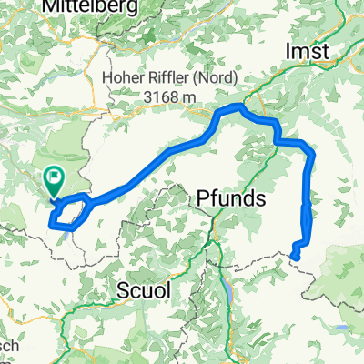
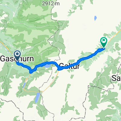
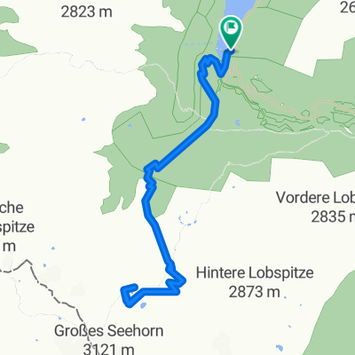
You start in Partenen and follow the steep Silvretta Hochalpenstraße up to the Vermunt reservoir. At the end of the lake, you turn right onto a gravel path and later turn left — this is the route to the staffed Saarbrückener Hut. The path is very steep and only suitable for very, very experienced mountain bikers. At the top, you can take a break and then ride back down to the Vermunt reservoir. From the gravel path at the bottom, turn left onto the Silvretta road, which you follow all the way to the Silvretta reservoir. Alternatively, if you didn't manage the climb to the Saarbrückener Hut, you can head to the staffed Wiesbadener Hut. This path isn’t marked, but you need to circle about halfway around the reservoir and follow the gravel road to the hut, which is not as steep as the route to the other hut. Returning to the main route, follow the Silvretta road towards Galtür (you can also use the gravel path next to the road). A few kilometers before Galtür, take the left descent to the Kopstausee reservoir. Follow the road all the way to the end of the Kopstausee. Then continue a bit further along the road and turn right onto a side road (watch for signs: direction Partenen). Follow this road down until you come out just before the toll station.
I liked this route because it is very challenging, the views of the glaciers are fantastic (especially from the two huts above the reservoirs), and you can really pick up speed on the descent from Silvretta reservoir.
To do this route, however, you need a good mountain bike and good weather, as otherwise the huts and lakes are often covered in clouds.
Have fun riding!!!
created this 16 years ago
Continue with Bikemap
You would like to ride Schwere Dreistauseerunde or customize it for your own trip? Here is what you can do with this Bikemap route:
Free trial for 3 days, or one-time payment. More about Bikemap Premium.
Discover more Premium features.
Get Bikemap PremiumFrom our community
Open it in the app