

Schelten und Chasseral
A cycling route starting in Oensingen, Canton of Solothurn, Switzerland.
Overview
About this route
Start from Oensingen Landi parking lot
-
Balsthal
-
Ramiswil
-
Schelten Pass
-
Mervelier
-
Courrendlin
-
Moutier
-
Tavannes
-
Saint-Imier
-
Chasseral
-
Nods
-
Lambong
-
Orvin
-
Grenchen
-
Bettlach
-
Selzach
-
Solothurn
-
Ober/Niederbipp
Finish at Oensingen Landi parking lot
Average gradient: 3%
Maximum gradient: 13%
- -:--
- Duration
- 163.8 km
- Distance
- 1,999 m
- Ascent
- 2,000 m
- Descent
- ---
- Avg. speed
- ---
- Max. altitude

Route quality
Waytypes & surfaces along the route
Waytypes
Road
65.5 km
(40 %)
Quiet road
16.4 km
(10 %)
Surfaces
Paved
85.2 km
(52 %)
Asphalt
85.2 km
(52 %)
Undefined
78.6 km
(48 %)
Continue with Bikemap
Use, edit, or download this cycling route
You would like to ride Schelten und Chasseral or customize it for your own trip? Here is what you can do with this Bikemap route:
Free features
- Save this route as favorite or in collections
- Copy & plan your own version of this route
- Split it into stages to create a multi-day tour
- Sync your route with Garmin or Wahoo
Premium features
Free trial for 3 days, or one-time payment. More about Bikemap Premium.
- Navigate this route on iOS & Android
- Export a GPX / KML file of this route
- Create your custom printout (try it for free)
- Download this route for offline navigation
Discover more Premium features.
Get Bikemap PremiumFrom our community
Other popular routes starting in Oensingen
 Oensingen Allerheiligenberg
- Distance
- 37.6 km
- Ascent
- 817 m
- Descent
- 814 m
- Location
- Oensingen, Canton of Solothurn, Switzerland
 Sur la Scheulte
- Distance
- 44.9 km
- Ascent
- 1,711 m
- Descent
- 883 m
- Location
- Oensingen, Canton of Solothurn, Switzerland
 Gigathlon 2012 - Rennvelostrecke Samstag
- Distance
- 101.4 km
- Ascent
- 1,501 m
- Descent
- 1,588 m
- Location
- Oensingen, Canton of Solothurn, Switzerland
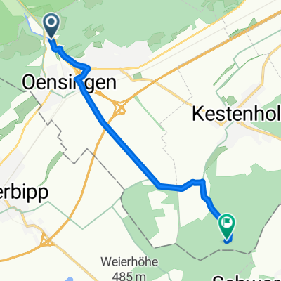
 Von Oensingen bis Kestenholz
- Distance
- 6.7 km
- Ascent
- 59 m
- Descent
- 60 m
- Location
- Oensingen, Canton of Solothurn, Switzerland
 Von Oensingen bis Kestenholz
- Distance
- 6.6 km
- Ascent
- 60 m
- Descent
- 60 m
- Location
- Oensingen, Canton of Solothurn, Switzerland
 Tag1 Oensingen-Schluchsee
- Distance
- 111.2 km
- Ascent
- 879 m
- Descent
- 340 m
- Location
- Oensingen, Canton of Solothurn, Switzerland
 Scheltenpass-Passwang Plus
- Distance
- 115.4 km
- Ascent
- 1,884 m
- Descent
- 1,858 m
- Location
- Oensingen, Canton of Solothurn, Switzerland
 Jurasüdfuss up'n'down
- Distance
- 51.3 km
- Ascent
- 1,803 m
- Descent
- 1,879 m
- Location
- Oensingen, Canton of Solothurn, Switzerland
Open it in the app