

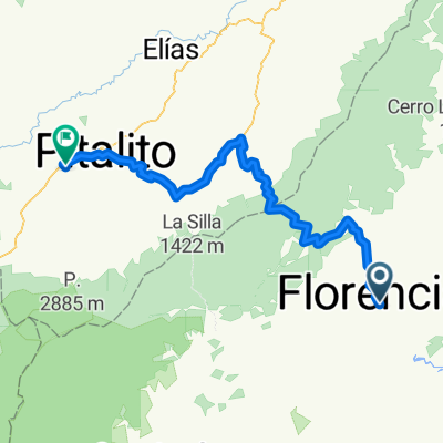
Florencia Altamira
A cycling route starting in Florencia, Departamento del Caquetá, Colombia.
Overview
About this route
Florencia (Caquetá), junction of Acevedo, Suaza, Altamira (Huila)
- -:--
- Duration
- 93.1 km
- Distance
- 2,375 m
- Ascent
- 1,603 m
- Descent
- ---
- Avg. speed
- ---
- Max. altitude
Route quality
Waytypes & surfaces along the route
Waytypes
Quiet road
10.2 km
(11 %)
Access road
0.9 km
(1 %)
Undefined
82 km
(88 %)
Surfaces
Paved
35.4 km
(38 %)
Asphalt
35.4 km
(38 %)
Undefined
57.7 km
(62 %)
Continue with Bikemap
Use, edit, or download this cycling route
You would like to ride Florencia Altamira or customize it for your own trip? Here is what you can do with this Bikemap route:
Free features
- Save this route as favorite or in collections
- Copy & plan your own version of this route
- Split it into stages to create a multi-day tour
- Sync your route with Garmin or Wahoo
Premium features
Free trial for 3 days, or one-time payment. More about Bikemap Premium.
- Navigate this route on iOS & Android
- Export a GPX / KML file of this route
- Create your custom printout (try it for free)
- Download this route for offline navigation
Discover more Premium features.
Get Bikemap PremiumFrom our community
Other popular routes starting in Florencia
 Florencia pitalito
- Distance
- 120.3 km
- Ascent
- 4,335 m
- Descent
- 3,304 m
- Location
- Florencia, Departamento del Caquetá, Colombia
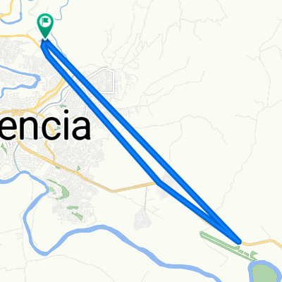
 Paseo rápido en Florencia
- Distance
- 5.4 km
- Ascent
- 148 m
- Descent
- 146 m
- Location
- Florencia, Departamento del Caquetá, Colombia
 De Calle 2 746, Florencia a Calle 13 3-47, Florencia
- Distance
- 1.4 km
- Ascent
- 11 m
- Descent
- 47 m
- Location
- Florencia, Departamento del Caquetá, Colombia
 De Florencia-La Montañita a Calle 20 Sur 11-09, Florencia
- Distance
- 7.1 km
- Ascent
- 96 m
- Descent
- 102 m
- Location
- Florencia, Departamento del Caquetá, Colombia
 De Calle 34 2E-73, Florencia a Calle 34 2E-73, Florencia
- Distance
- 46.5 km
- Ascent
- 0 m
- Descent
- 88 m
- Location
- Florencia, Departamento del Caquetá, Colombia
 De Calle 20 Sur 11-09, Florencia a Florencia-La Montañita
- Distance
- 7 km
- Ascent
- 87 m
- Descent
- 77 m
- Location
- Florencia, Departamento del Caquetá, Colombia
 nbvnvbnjv
- Distance
- 184.5 km
- Ascent
- 4,561 m
- Descent
- 3,178 m
- Location
- Florencia, Departamento del Caquetá, Colombia
 De Calle 26A a Calle 26A
- Distance
- 0 km
- Ascent
- 0 m
- Descent
- 0 m
- Location
- Florencia, Departamento del Caquetá, Colombia
Open it in the app