
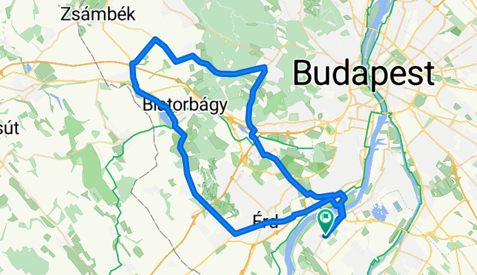
Biatorbágy - Páty - Sóskút
A cycling route starting in Halásztelek, Pest megye, Hungary.
Overview
About this route
Enyhén dombos
- -:--
- Duration
- 73.6 km
- Distance
- 325 m
- Ascent
- 325 m
- Descent
- ---
- Avg. speed
- ---
- Avg. speed

Continue with Bikemap
Use, edit, or download this cycling route
You would like to ride Biatorbágy - Páty - Sóskút or customize it for your own trip? Here is what you can do with this Bikemap route:
Free features
- Save this route as favorite or in collections
- Copy & plan your own version of this route
- Sync your route with Garmin or Wahoo
Premium features
Free trial for 3 days, or one-time payment. More about Bikemap Premium.
- Navigate this route on iOS & Android
- Export a GPX / KML file of this route
- Create your custom printout (try it for free)
- Download this route for offline navigation
Discover more Premium features.
Get Bikemap PremiumFrom our community
Other popular routes starting in Halásztelek
 Velence hosszú (Agárddal)
- Distance
- 129.7 km
- Ascent
- 591 m
- Descent
- 593 m
- Location
- Halásztelek, Pest megye, Hungary
 Csepeli - kör
- Distance
- 35 km
- Ascent
- 20 m
- Descent
- 19 m
- Location
- Halásztelek, Pest megye, Hungary
 Makád kör
- Distance
- 82.3 km
- Ascent
- 17 m
- Descent
- 19 m
- Location
- Halásztelek, Pest megye, Hungary
 Bringázás Etyek felé
- Distance
- 76.6 km
- Ascent
- 468 m
- Descent
- 469 m
- Location
- Halásztelek, Pest megye, Hungary
 HTK-Ráckeve-HTK (Szigetújfalu kitérővel)
- Distance
- 62.7 km
- Ascent
- 4 m
- Descent
- 4 m
- Location
- Halásztelek, Pest megye, Hungary
 Dr. Nagy Sándor: KERÉKPÁRON Budapest körül I.
- Distance
- 32.9 km
- Ascent
- 178 m
- Descent
- 144 m
- Location
- Halásztelek, Pest megye, Hungary
 Halásztelek - Ráckeve - Halásztelek
- Distance
- 58.7 km
- Ascent
- 4 m
- Descent
- 4 m
- Location
- Halásztelek, Pest megye, Hungary
 Plan1
Plan1- Distance
- 58 km
- Ascent
- 192 m
- Descent
- 195 m
- Location
- Halásztelek, Pest megye, Hungary
Open it in the app