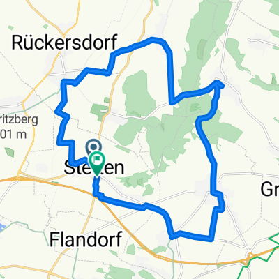
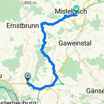
Stetten-Sierndorf-Ernstbrunn-Stetten
- 64.8 km
- 200 m
- 124 m
- Stetten, Lower Austria, Austria
A cycling route starting in Stetten, Lower Austria, Austria.
Overview
Scenic route, partially busier sections like between Korneuburg and Stockerau and after Ersnstbrunn on Laaerstraße. Short climbs. Fountain in Erstbrunn.
created this 16 years ago
Route quality
Quiet road
11 km
17 %
Road
9.7 km
15 %
Paved
44 km
(68 %)
Unpaved
2.6 km
(4 %)
Asphalt
43.4 km
67 %
Gravel
1.3 km
2 %
Continue with Bikemap
You would like to ride Stetten-Sierndorf-Ernstbrunn-Stetten or customize it for your own trip? Here is what you can do with this Bikemap route:
Free trial for 3 days, or one-time payment. More about Bikemap Premium.
Discover more Premium features.
Get Bikemap PremiumFrom our community
Open it in the app