

Beato Emerico
A cycling route starting in Villair-Amerique, Aosta Valley, Italy.
Overview
About this route
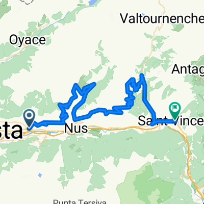
Castello di Quart - Trois Villes - Beato Emerico
- -:--
- Duration
- 11.5 km
- Distance
- 672 m
- Ascent
- 658 m
- Descent
- ---
- Avg. speed
- ---
- Max. altitude

Continue with Bikemap
Use, edit, or download this cycling route
You would like to ride Beato Emerico or customize it for your own trip? Here is what you can do with this Bikemap route:
Free features
- Save this route as favorite or in collections
- Copy & plan your own version of this route
- Sync your route with Garmin or Wahoo
Premium features
Free trial for 3 days, or one-time payment. More about Bikemap Premium.
- Navigate this route on iOS & Android
- Export a GPX / KML file of this route
- Create your custom printout (try it for free)
- Download this route for offline navigation
Discover more Premium features.
Get Bikemap PremiumFrom our community
Other popular routes starting in Villair-Amerique
 gran s bernardo
- Distance
- 40 km
- Ascent
- 1,901 m
- Descent
- 0 m
- Location
- Villair-Amerique, Aosta Valley, Italy
 Beato Emerico
- Distance
- 11.5 km
- Ascent
- 672 m
- Descent
- 658 m
- Location
- Villair-Amerique, Aosta Valley, Italy
 aosta climb
- Distance
- 131.3 km
- Ascent
- 2,616 m
- Descent
- 2,616 m
- Location
- Villair-Amerique, Aosta Valley, Italy
 Visey
Visey- Distance
- 46.4 km
- Ascent
- 1,015 m
- Descent
- 338 m
- Location
- Villair-Amerique, Aosta Valley, Italy
 Aosta 140km
- Distance
- 140 km
- Ascent
- 3,485 m
- Descent
- 3,503 m
- Location
- Villair-Amerique, Aosta Valley, Italy
 Valpelline Place Moulin + Pila
- Distance
- 108.5 km
- Ascent
- 2,696 m
- Descent
- 2,696 m
- Location
- Villair-Amerique, Aosta Valley, Italy
 Aosta - San Pantaleone - St-Vincent
- Distance
- 68.3 km
- Ascent
- 1,991 m
- Descent
- 1,954 m
- Location
- Villair-Amerique, Aosta Valley, Italy
 valpelline
- Distance
- 41 km
- Ascent
- 1,598 m
- Descent
- 149 m
- Location
- Villair-Amerique, Aosta Valley, Italy
Open it in the app