

Rund um die Dammer Berge
A cycling route starting in Damme, Lower Saxony, Germany.
Overview
About this route
Offizielle Radwanderroute des Landkreises Vechta (Symbol Berge).
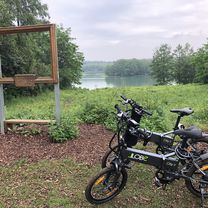
Das Erholungsgebiet Dammer Berge umfaßt das Gebiet der Stadt Damme sowie der Gemeinden Holdorf, Neuenkirchen-Vörden und Steinfeld. Die Radtour führt entlang einer abwechselungsreichen Landschaft mit großen Waldgebieten, Wiesentälern und Gewässern.
In Damme (Stadtmuseum mit großen Parkplatz) starten Sie Richtung Rottinghausen, vorbei am Flugplatz und Römerschanzen über Astrup nach Vörden. Von Vörden fahren Sie weiter Richtung Neuenkirchen, danach Richtung Holdorf, vorbei am Heidesee. Von Holdorf Richtung Steinfeld, dann Schemder Bergmark (Ponyhof) in die Dammer Schweiz. Aussichtsturm Mordkuhlenberg zurück nach Damme.
Wer die Tour in angegebener Richtung fährt braucht für die letzten 10 km noch eine gute Kondition, da dann einige leichte Anstiege zu meistern sind. Minimaler gut befahrbarer Schotteranteil, läßt sich teilweise auch umfahren.
- -:--
- Duration
- 54.8 km
- Distance
- 118 m
- Ascent
- 89 m
- Descent
- ---
- Avg. speed
- 93 m
- Max. altitude
Route quality
Waytypes & surfaces along the route
Waytypes
Quiet road
24.1 km
(44 %)
Path
11.5 km
(21 %)
Surfaces
Paved
38 km
(69 %)
Unpaved
2 km
(4 %)
Asphalt
36 km
(66 %)
Gravel
2 km
(4 %)
Continue with Bikemap
Use, edit, or download this cycling route
You would like to ride Rund um die Dammer Berge or customize it for your own trip? Here is what you can do with this Bikemap route:
Free features
- Save this route as favorite or in collections
- Copy & plan your own version of this route
- Sync your route with Garmin or Wahoo
Premium features
Free trial for 3 days, or one-time payment. More about Bikemap Premium.
- Navigate this route on iOS & Android
- Export a GPX / KML file of this route
- Create your custom printout (try it for free)
- Download this route for offline navigation
Discover more Premium features.
Get Bikemap PremiumFrom our community
Other popular routes starting in Damme
 3 Seen Route
- Distance
- 237.9 km
- Ascent
- 451 m
- Descent
- 481 m
- Location
- Damme, Lower Saxony, Germany
 Aussichtsturm Mordkuhlenberg und Bergsee
- Distance
- 4.1 km
- Ascent
- 328 m
- Descent
- 353 m
- Location
- Damme, Lower Saxony, Germany
 Dümmertour 01. Mai 2010
- Distance
- 37.7 km
- Ascent
- 38 m
- Descent
- 39 m
- Location
- Damme, Lower Saxony, Germany
 Hausstrecke
- Distance
- 30.8 km
- Ascent
- 117 m
- Descent
- 91 m
- Location
- Damme, Lower Saxony, Germany
 Wanderroute rund um Damme
- Distance
- 8.9 km
- Ascent
- 116 m
- Descent
- 116 m
- Location
- Damme, Lower Saxony, Germany
 damme
damme- Distance
- 11.3 km
- Ascent
- 149 m
- Descent
- 149 m
- Location
- Damme, Lower Saxony, Germany
 Rüschendorf, Schweizerhaus, Stöltings Ziegelei, Damme und zurück
- Distance
- 20.2 km
- Ascent
- 159 m
- Descent
- 144 m
- Location
- Damme, Lower Saxony, Germany
 MTB-Sonntagstour des OSC-Damme CLONED FROM ROUTE 226598
- Distance
- 18.5 km
- Ascent
- 202 m
- Descent
- 201 m
- Location
- Damme, Lower Saxony, Germany
Open it in the app