Sömmerda-Runde
A cycling route starting in Sömmerda, Thuringia, Germany.
Overview
About this route
Nice ride based on the Evening Ride No.7.
Everything included: asphalt, cobbled road, field path, gravel track, bike trail.
No to minimal road traffic!
Mountain bike recommended. Possible with a trekking bike, but caution needed on the gravel track.
- -:--
- Duration
- 21 km
- Distance
- 87 m
- Ascent
- 87 m
- Descent
- ---
- Avg. speed
- 223 m
- Max. altitude
Route quality
Waytypes & surfaces along the route
Waytypes
Track
13.9 km
(66 %)
Access road
2.1 km
(10 %)
Surfaces
Paved
10.7 km
(51 %)
Unpaved
7.1 km
(34 %)
Asphalt
7.6 km
(36 %)
Paved (undefined)
3.1 km
(15 %)
Route highlights
Points of interest along the route
Point of interest after 5 km
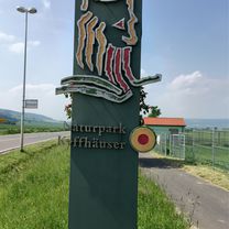
Kleine Pause? Auf dem Modellflugplatz ist Abends und und am Wochenende imer was los.
Continue with Bikemap
Use, edit, or download this cycling route
You would like to ride Sömmerda-Runde or customize it for your own trip? Here is what you can do with this Bikemap route:
Free features
- Save this route as favorite or in collections
- Copy & plan your own version of this route
- Sync your route with Garmin or Wahoo
Premium features
Free trial for 3 days, or one-time payment. More about Bikemap Premium.
- Navigate this route on iOS & Android
- Export a GPX / KML file of this route
- Create your custom printout (try it for free)
- Download this route for offline navigation
Discover more Premium features.
Get Bikemap PremiumFrom our community
Other popular routes starting in Sömmerda
- Sömmerda-Blankenhain-Quirla
- Distance
- 89.8 km
- Ascent
- 1,112 m
- Descent
- 985 m
- Location
- Sömmerda, Thuringia, Germany
- ab Tunzenhausen-Weißenburg bei (Sömmmerda) unbefestigten Weg😕
- Distance
- 39.2 km
- Ascent
- 110 m
- Descent
- 111 m
- Location
- Sömmerda, Thuringia, Germany
- Die schönste Radtour
- Distance
- 47.8 km
- Ascent
- 43 m
- Descent
- 43 m
- Location
- Sömmerda, Thuringia, Germany
- Söm - Bad Kösen - Söm
- Distance
- 103.1 km
- Ascent
- 490 m
- Descent
- 490 m
- Location
- Sömmerda, Thuringia, Germany
- Sömmerda-Grüningen-Sömmerda
- Distance
- 44.6 km
- Ascent
- 136 m
- Descent
- 137 m
- Location
- Sömmerda, Thuringia, Germany
- Sömmerda-Alperstedt-Sömmerda
- Distance
- 24.3 km
- Ascent
- 93 m
- Descent
- 96 m
- Location
- Sömmerda, Thuringia, Germany
- Unstrut-Saale Etappe 4
- Distance
- 42.9 km
- Ascent
- 60 m
- Descent
- 76 m
- Location
- Sömmerda, Thuringia, Germany
- Sömmerda-Runde
- Distance
- 21 km
- Ascent
- 87 m
- Descent
- 87 m
- Location
- Sömmerda, Thuringia, Germany
Open it in the app