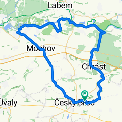
ČeskýBrod-KutnáHora-Cerhenice
A cycling route starting in Český Brod, Central Bohemia, Czechia.
Overview
About this route
ČeskýBrod-KutnáHora-Cerhenice
- -:--
- Duration
- 77 km
- Distance
- 400 m
- Ascent
- 425 m
- Descent
- ---
- Avg. speed
- ---
- Max. altitude
Route quality
Waytypes & surfaces along the route
Waytypes
Road
51.8 km
(67 %)
Busy road
12 km
(16 %)
Surfaces
Paved
36 km
(47 %)
Unpaved
0.1 km
(<1 %)
Asphalt
34.7 km
(45 %)
Paved (undefined)
0.8 km
(1 %)
Continue with Bikemap
Use, edit, or download this cycling route
You would like to ride ČeskýBrod-KutnáHora-Cerhenice or customize it for your own trip? Here is what you can do with this Bikemap route:
Free features
- Save this route as favorite or in collections
- Copy & plan your own version of this route
- Sync your route with Garmin or Wahoo
Premium features
Free trial for 3 days, or one-time payment. More about Bikemap Premium.
- Navigate this route on iOS & Android
- Export a GPX / KML file of this route
- Create your custom printout (try it for free)
- Download this route for offline navigation
Discover more Premium features.
Get Bikemap PremiumFrom our community
Other popular routes starting in Český Brod
- Cesky Brod to Ricany
- Distance
- 29.5 km
- Ascent
- 337 m
- Descent
- 208 m
- Location
- Český Brod, Central Bohemia, Czechia
- Sázava XL 2
- Distance
- 78.1 km
- Ascent
- 1,132 m
- Descent
- 1,143 m
- Location
- Český Brod, Central Bohemia, Czechia
- fdsfd
- Distance
- 28.3 km
- Ascent
- 288 m
- Descent
- 174 m
- Location
- Český Brod, Central Bohemia, Czechia
- jjjjjjjjj
- Distance
- 22.4 km
- Ascent
- 136 m
- Descent
- 164 m
- Location
- Český Brod, Central Bohemia, Czechia
- ČeskýBrod-KutnáHora-Cerhenice
- Distance
- 77 km
- Ascent
- 400 m
- Descent
- 425 m
- Location
- Český Brod, Central Bohemia, Czechia
- Český Brod, Voděrady, Hostivař, metro Skalka
- Distance
- 59.7 km
- Ascent
- 541 m
- Descent
- 517 m
- Location
- Český Brod, Central Bohemia, Czechia
- Brod přes Kersko do Čelákovic a zpět
- Distance
- 48.8 km
- Ascent
- 126 m
- Descent
- 128 m
- Location
- Český Brod, Central Bohemia, Czechia
- Sázava
- Distance
- 67.3 km
- Ascent
- 709 m
- Descent
- 714 m
- Location
- Český Brod, Central Bohemia, Czechia
Open it in the app