
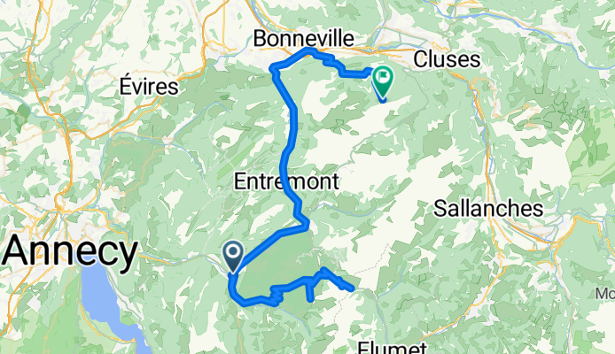
Col de la Croix Fry and Col des Aravis
A cycling route starting in Thônes, Auvergne-Rhône-Alpes, France.
Overview
About this route
None (cloned from route 819644)
- -:--
- Duration
- 93.7 km
- Distance
- 2,692 m
- Ascent
- 1,873 m
- Descent
- ---
- Avg. speed
- ---
- Max. altitude
Route quality
Waytypes & surfaces along the route
Waytypes
Road
15 km
(16 %)
Quiet road
9.4 km
(10 %)
Surfaces
Paved
65.6 km
(70 %)
Unpaved
1.9 km
(2 %)
Asphalt
65.6 km
(70 %)
Unpaved (undefined)
0.9 km
(1 %)
Route highlights
Points of interest along the route
Point of interest after 13.2 km
Col de la Croix Fry
Point of interest after 16.1 km
Col de Merdassier
Point of interest after 26.4 km
Col des Aravis
Continue with Bikemap
Use, edit, or download this cycling route
You would like to ride Col de la Croix Fry and Col des Aravis or customize it for your own trip? Here is what you can do with this Bikemap route:
Free features
- Save this route as favorite or in collections
- Copy & plan your own version of this route
- Split it into stages to create a multi-day tour
- Sync your route with Garmin or Wahoo
Premium features
Free trial for 3 days, or one-time payment. More about Bikemap Premium.
- Navigate this route on iOS & Android
- Export a GPX / KML file of this route
- Create your custom printout (try it for free)
- Download this route for offline navigation
Discover more Premium features.
Get Bikemap PremiumFrom our community
Other popular routes starting in Thônes
 66-560 Thones-Annecy
- Distance
- 66.3 km
- Ascent
- 475 m
- Descent
- 474 m
- Location
- Thônes, Auvergne-Rhône-Alpes, France
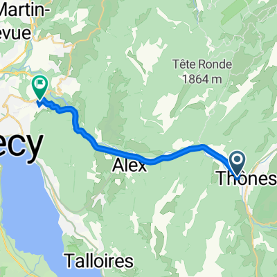 От Rue Saint-Blaise 4, Thônes до Route de Thônes 79, Annecy
- Distance
- 14.4 km
- Ascent
- 257 m
- Descent
- 301 m
- Location
- Thônes, Auvergne-Rhône-Alpes, France
 Day 4 Leg 4 col de la fry to annecy finish!
- Distance
- 32.4 km
- Ascent
- 158 m
- Descent
- 1,020 m
- Location
- Thônes, Auvergne-Rhône-Alpes, France
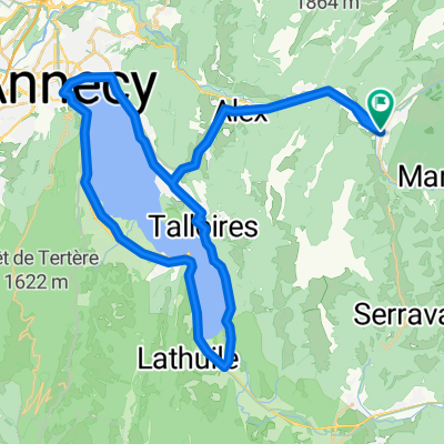
 JH Manigod -> Thones -> La Clusaz -> Manigod
- Distance
- 31.4 km
- Ascent
- 881 m
- Descent
- 881 m
- Location
- Thônes, Auvergne-Rhône-Alpes, France
 Haute Savoie: 111 km: Thônes - La Clusaz - Col Aravais - Col des Saisies - Col de la Forclaz de Queige - Ugine - Marlens - Col de l'Epine - Serraval - Thônes
- Distance
- 111.3 km
- Ascent
- 2,455 m
- Descent
- 2,455 m
- Location
- Thônes, Auvergne-Rhône-Alpes, France
 thônes et alpages des Confins
- Distance
- 17.4 km
- Ascent
- 836 m
- Descent
- 82 m
- Location
- Thônes, Auvergne-Rhône-Alpes, France
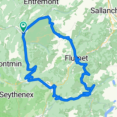
 Col de la Croix Fry and Col des Aravis
- Distance
- 48.2 km
- Ascent
- 1,390 m
- Descent
- 1,390 m
- Location
- Thônes, Auvergne-Rhône-Alpes, France
 Col de la Croix Fry and Aravis
- Distance
- 52.1 km
- Ascent
- 1,564 m
- Descent
- 1,551 m
- Location
- Thônes, Auvergne-Rhône-Alpes, France
Open it in the app