

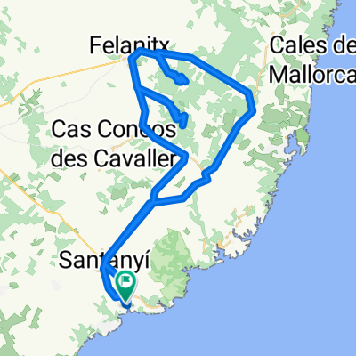
FELANITX-SON FANGOS-NARANJO-SES TORRES-SANT JOAN-CALDERERS-PORRERES-CAMPOS
A cycling route starting in Santanyí, Balearic Islands, Spain.
Overview
About this route
CLUB CICLISTA SANTANYI
- -:--
- Duration
- 100.1 km
- Distance
- 484 m
- Ascent
- 484 m
- Descent
- ---
- Avg. speed
- ---
- Max. altitude

Route quality
Waytypes & surfaces along the route
Waytypes
Road
29 km
(29 %)
Quiet road
23 km
(23 %)
Surfaces
Paved
89.1 km
(89 %)
Asphalt
89.1 km
(89 %)
Undefined
11 km
(11 %)
Continue with Bikemap
Use, edit, or download this cycling route
You would like to ride FELANITX-SON FANGOS-NARANJO-SES TORRES-SANT JOAN-CALDERERS-PORRERES-CAMPOS or customize it for your own trip? Here is what you can do with this Bikemap route:
Free features
- Save this route as favorite or in collections
- Copy & plan your own version of this route
- Split it into stages to create a multi-day tour
- Sync your route with Garmin or Wahoo
Premium features
Free trial for 3 days, or one-time payment. More about Bikemap Premium.
- Navigate this route on iOS & Android
- Export a GPX / KML file of this route
- Create your custom printout (try it for free)
- Download this route for offline navigation
Discover more Premium features.
Get Bikemap PremiumFrom our community
Other popular routes starting in Santanyí
 Cala Santanyi SES SALINES SAN JORDI
- Distance
- 44.9 km
- Ascent
- 485 m
- Descent
- 333 m
- Location
- Santanyí, Balearic Islands, Spain
 Santanyí, Felanitx, Cala d'Or
- Distance
- 45.3 km
- Ascent
- 515 m
- Descent
- 512 m
- Location
- Santanyí, Balearic Islands, Spain
 Santanyi 2010
- Distance
- 57.8 km
- Ascent
- 623 m
- Descent
- 623 m
- Location
- Santanyí, Balearic Islands, Spain
 FELANITX-PORRERES-VILAFRANCA-ELS CALDERERS-PINA-CAMI MUNTANYA-SON MARRANO-SES SALINES
- Distance
- 102.4 km
- Ascent
- 419 m
- Descent
- 418 m
- Location
- Santanyí, Balearic Islands, Spain
 Santanyi_ueber_zwei_Berge
- Distance
- 67.4 km
- Ascent
- 1,038 m
- Descent
- 965 m
- Location
- Santanyí, Balearic Islands, Spain
 MONTISION-CURA-SANT MIQUEL-BONANY-SANT SALVADOR
- Distance
- 128.5 km
- Ascent
- 1,222 m
- Descent
- 1,222 m
- Location
- Santanyí, Balearic Islands, Spain
 Ruta des Sud
- Distance
- 35 km
- Ascent
- 140 m
- Descent
- 142 m
- Location
- Santanyí, Balearic Islands, Spain
 CAMPOS-CONSELL-ORIENT-BUNYOLA-STA MARIA-STA.EUGENIA-CAMPOS
- Distance
- 136.9 km
- Ascent
- 804 m
- Descent
- 804 m
- Location
- Santanyí, Balearic Islands, Spain
Open it in the app