

Bobici na kole #02-D05 (Venedigo)
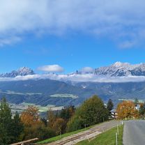
A cycling route starting in Schwaz, Tyrol, Austria.
Overview
About this route
09/08/2006
Tacho: 94/384 km Time: 4:56 Avg: 19.0 Note: automatic route- -:--
- Duration
- 88.9 km
- Distance
- 470 m
- Ascent
- 266 m
- Descent
- ---
- Avg. speed
- ---
- Max. altitude
Route quality
Waytypes & surfaces along the route
Waytypes
Quiet road
10.7 km
(12 %)
Access road
4.4 km
(5 %)
Surfaces
Paved
80.9 km
(91 %)
Asphalt
80 km
(90 %)
Paved (undefined)
0.9 km
(1 %)
Undefined
8 km
(9 %)
Continue with Bikemap
Use, edit, or download this cycling route
You would like to ride Bobici na kole #02-D05 (Venedigo) or customize it for your own trip? Here is what you can do with this Bikemap route:
Free features
- Save this route as favorite or in collections
- Copy & plan your own version of this route
- Split it into stages to create a multi-day tour
- Sync your route with Garmin or Wahoo
Premium features
Free trial for 3 days, or one-time payment. More about Bikemap Premium.
- Navigate this route on iOS & Android
- Export a GPX / KML file of this route
- Create your custom printout (try it for free)
- Download this route for offline navigation
Discover more Premium features.
Get Bikemap PremiumFrom our community
Other popular routes starting in Schwaz
 Radtour nach Wien
- Distance
- 483.5 km
- Ascent
- 622 m
- Descent
- 971 m
- Location
- Schwaz, Tyrol, Austria
 Schwaz, Pillberg, Loassattel, Hochfügen, Brixlegg
- Distance
- 49.7 km
- Ascent
- 1,397 m
- Descent
- 1,486 m
- Location
- Schwaz, Tyrol, Austria
 Umdie Hohe Salve
- Distance
- 105.9 km
- Ascent
- 553 m
- Descent
- 587 m
- Location
- Schwaz, Tyrol, Austria
 Schwaz Loashaus
- Distance
- 10.7 km
- Ascent
- 1,085 m
- Descent
- 4 m
- Location
- Schwaz, Tyrol, Austria
 Transalp Bayern-Bozen
- Distance
- 262.6 km
- Ascent
- 6,763 m
- Descent
- 7,028 m
- Location
- Schwaz, Tyrol, Austria
 Sonntagsrunde Georgenberg
- Distance
- 16.4 km
- Ascent
- 500 m
- Descent
- 418 m
- Location
- Schwaz, Tyrol, Austria
 Schwaz nach Ebbs mit dörfern
- Distance
- 66.4 km
- Ascent
- 359 m
- Descent
- 441 m
- Location
- Schwaz, Tyrol, Austria
 Schwaz – Weerberg – Geiseljoch - Mayerhofen
- Distance
- 55.3 km
- Ascent
- 1,831 m
- Descent
- 1,742 m
- Location
- Schwaz, Tyrol, Austria
Open it in the app