

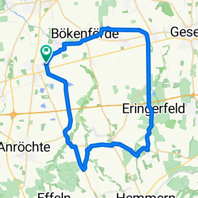
Kulturlandschaft Hellweg: Radroute rund um Erwitte und Bad Westernkotten
A cycling route starting in Erwitte, North Rhine-Westphalia, Germany.
Overview
About this route
<p>
</p>
Translated, show original (German)- -:--
- Duration
- 17.9 km
- Distance
- 71 m
- Ascent
- 71 m
- Descent
- ---
- Avg. speed
- ---
- Max. altitude

Route quality
Waytypes & surfaces along the route
Waytypes
Quiet road
5.5 km
(31 %)
Track
5.4 km
(30 %)
Surfaces
Paved
10.2 km
(57 %)
Unpaved
2.9 km
(16 %)
Asphalt
8.2 km
(46 %)
Gravel
2.7 km
(15 %)
Continue with Bikemap
Use, edit, or download this cycling route
You would like to ride Kulturlandschaft Hellweg: Radroute rund um Erwitte und Bad Westernkotten or customize it for your own trip? Here is what you can do with this Bikemap route:
Free features
- Save this route as favorite or in collections
- Copy & plan your own version of this route
- Sync your route with Garmin or Wahoo
Premium features
Free trial for 3 days, or one-time payment. More about Bikemap Premium.
- Navigate this route on iOS & Android
- Export a GPX / KML file of this route
- Create your custom printout (try it for free)
- Download this route for offline navigation
Discover more Premium features.
Get Bikemap PremiumFrom our community
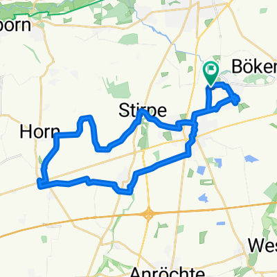
Other popular routes starting in Erwitte
 Flach, super Wegdecken, wenig Verkehr
- Distance
- 53.4 km
- Ascent
- 85 m
- Descent
- 83 m
- Location
- Erwitte, North Rhine-Westphalia, Germany
 Erwitte - Langenstr. - Nettelstädt -Erwitte
- Distance
- 35.9 km
- Ascent
- 258 m
- Descent
- 161 m
- Location
- Erwitte, North Rhine-Westphalia, Germany
 Bad Westerkotten-Soest-Lippstadt
- Distance
- 64.9 km
- Ascent
- 167 m
- Descent
- 168 m
- Location
- Erwitte, North Rhine-Westphalia, Germany
 Radtour Bad Westernkotten - Naturerlebnis Auenland III
- Distance
- 46.4 km
- Ascent
- 76 m
- Descent
- 74 m
- Location
- Erwitte, North Rhine-Westphalia, Germany
 Kulturlandschaft Hellweg: Radroute rund um Erwitte und Bad Westernkotten
- Distance
- 17.9 km
- Ascent
- 71 m
- Descent
- 71 m
- Location
- Erwitte, North Rhine-Westphalia, Germany
 Verkehrsarm Rund um Lippstadt
- Distance
- 80.6 km
- Ascent
- 113 m
- Descent
- 113 m
- Location
- Erwitte, North Rhine-Westphalia, Germany
 Mühlen-Route
- Distance
- 27.7 km
- Ascent
- 67 m
- Descent
- 67 m
- Location
- Erwitte, North Rhine-Westphalia, Germany
 Rundkurs Erwitte - Sassendorf
- Distance
- 38.1 km
- Ascent
- 69 m
- Descent
- 69 m
- Location
- Erwitte, North Rhine-Westphalia, Germany
Open it in the app