

Chateau Queyras-Molines Queyras-Agnel
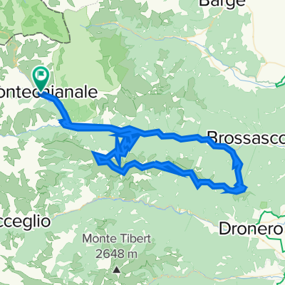
A cycling route starting in Pontechianale, Piedmont, Italy.
Overview
About this route
Ida y vuelta por el mismo camino. Se sale deChateau Queyras hasta el Coll de Agnel y se regresa.
- -:--
- Duration
- 43.5 km
- Distance
- 1,400 m
- Ascent
- 1,418 m
- Descent
- ---
- Avg. speed
- ---
- Max. altitude

Route quality
Waytypes & surfaces along the route
Waytypes
Busy road
31.8 km
(73 %)
Path
6.6 km
(15 %)
Surfaces
Paved
4.7 km
(11 %)
Unpaved
0.8 km
(2 %)
Asphalt
4.7 km
(11 %)
Loose gravel
0.6 km
(1 %)
Continue with Bikemap
Use, edit, or download this cycling route
You would like to ride Chateau Queyras-Molines Queyras-Agnel or customize it for your own trip? Here is what you can do with this Bikemap route:
Free features
- Save this route as favorite or in collections
- Copy & plan your own version of this route
- Sync your route with Garmin or Wahoo
Premium features
Free trial for 3 days, or one-time payment. More about Bikemap Premium.
- Navigate this route on iOS & Android
- Export a GPX / KML file of this route
- Create your custom printout (try it for free)
- Download this route for offline navigation
Discover more Premium features.
Get Bikemap PremiumFrom our community
Other popular routes starting in Pontechianale
 L'Agnel
- Distance
- 28.4 km
- Ascent
- 1,197 m
- Descent
- 1,198 m
- Location
- Pontechianale, Piedmont, Italy
 Guilestre Agnel
- Distance
- 43.2 km
- Ascent
- 535 m
- Descent
- 2,249 m
- Location
- Pontechianale, Piedmont, Italy
 Chateau Queyras-Molines Queyras-Agnel
- Distance
- 43.5 km
- Ascent
- 1,400 m
- Descent
- 1,418 m
- Location
- Pontechianale, Piedmont, Italy
 T2F-2020-6.tre colli
- Distance
- 117.9 km
- Ascent
- 3,405 m
- Descent
- 4,368 m
- Location
- Pontechianale, Piedmont, Italy
 T2F-2020-6.leggero
- Distance
- 135.9 km
- Ascent
- 3,260 m
- Descent
- 4,222 m
- Location
- Pontechianale, Piedmont, Italy
 Vom Col Agnel über den Col d´Izohrad, den Col du Galibier nach L´Aple D´Huez
- Distance
- 159 km
- Ascent
- 4,566 m
- Descent
- 4,333 m
- Location
- Pontechianale, Piedmont, Italy
 Italia desde Pontechanale a Risoul
- Distance
- 70 km
- Ascent
- 2,065 m
- Descent
- 1,856 m
- Location
- Pontechianale, Piedmont, Italy
 CannSamp100/2700
- Distance
- 100.5 km
- Ascent
- 3,243 m
- Descent
- 3,249 m
- Location
- Pontechianale, Piedmont, Italy
Open it in the app