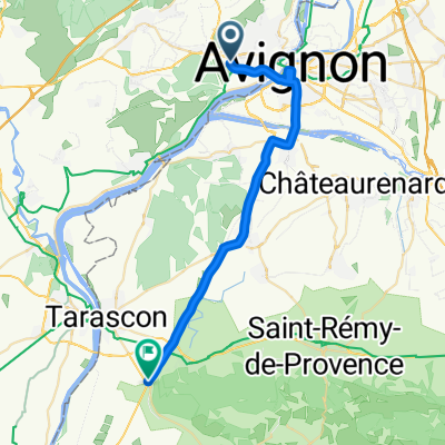
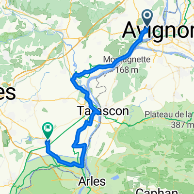
LES ANGLES 20KM
A cycling route starting in Les Angles, Occitanie, France.
Overview
About this route
TEASI Track
- -:--
- Duration
- 19.6 km
- Distance
- 224 m
- Ascent
- 221 m
- Descent
- ---
- Avg. speed
- ---
- Max. altitude
Route quality
Waytypes & surfaces along the route
Waytypes
Path
7.2 km
(37 %)
Track
7.1 km
(36 %)
Surfaces
Paved
3.1 km
(16 %)
Unpaved
0.6 km
(3 %)
Asphalt
3.1 km
(16 %)
Gravel
0.6 km
(3 %)
Undefined
15.9 km
(81 %)
Route highlights
Points of interest along the route
Point of interest after 0 km
Continue with Bikemap
Use, edit, or download this cycling route
You would like to ride LES ANGLES 20KM or customize it for your own trip? Here is what you can do with this Bikemap route:
Free features
- Save this route as favorite or in collections
- Copy & plan your own version of this route
- Sync your route with Garmin or Wahoo
Premium features
Free trial for 3 days, or one-time payment. More about Bikemap Premium.
- Navigate this route on iOS & Android
- Export a GPX / KML file of this route
- Create your custom printout (try it for free)
- Download this route for offline navigation
Discover more Premium features.
Get Bikemap PremiumFrom our community
Other popular routes starting in Les Angles
LES ANGLES Ξ RP RAV- Distance
- 19.2 km
- Ascent
- 262 m
- Descent
- 273 m
- Location
- Les Angles, Occitanie, France
straight- Distance
- 98.7 km
- Ascent
- 154 m
- Descent
- 167 m
- Location
- Les Angles, Occitanie, France
Avignon-LaPetitteMotte 96km- Distance
- 96.5 km
- Ascent
- 157 m
- Descent
- 172 m
- Location
- Les Angles, Occitanie, France
Rochefort du Gard - Saintes Maries de la Mer 2- Distance
- 89.8 km
- Ascent
- 43 m
- Descent
- 112 m
- Location
- Les Angles, Occitanie, France
avignon agde- Distance
- 156.4 km
- Ascent
- 121 m
- Descent
- 123 m
- Location
- Les Angles, Occitanie, France
Lily's track- Distance
- 17.3 km
- Ascent
- 104 m
- Descent
- 116 m
- Location
- Les Angles, Occitanie, France
Helena & Fred- Distance
- 61.8 km
- Ascent
- 474 m
- Descent
- 474 m
- Location
- Les Angles, Occitanie, France
aller Cévennes 17juin- Distance
- 97.9 km
- Ascent
- 1,698 m
- Descent
- 1,159 m
- Location
- Les Angles, Occitanie, France
Open it in the app

