
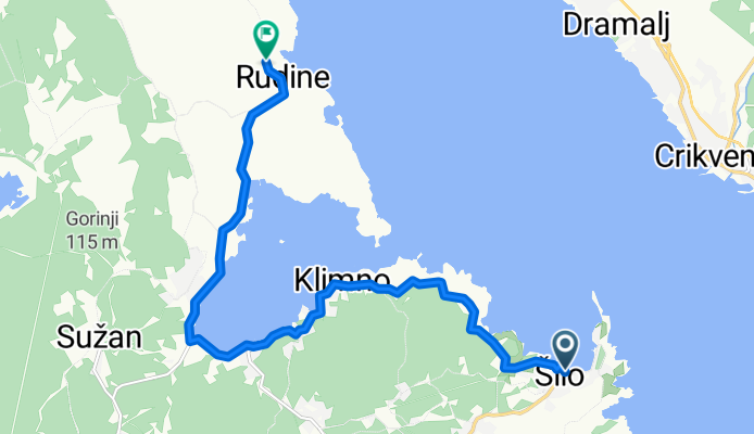
Šilo-Biserujka (cesta+makadam)
A cycling route starting in Crikvenica, Primorje-Gorski Kotar County, Croatia.
Overview
About this route
Šilo-Biserujka (cesta+makadam)
- -:--
- Duration
- 11.4 km
- Distance
- 139 m
- Ascent
- 136 m
- Descent
- ---
- Avg. speed
- ---
- Max. altitude

Continue with Bikemap
Use, edit, or download this cycling route
You would like to ride Šilo-Biserujka (cesta+makadam) or customize it for your own trip? Here is what you can do with this Bikemap route:
Free features
- Save this route as favorite or in collections
- Copy & plan your own version of this route
- Sync your route with Garmin or Wahoo
Premium features
Free trial for 3 days, or one-time payment. More about Bikemap Premium.
- Navigate this route on iOS & Android
- Export a GPX / KML file of this route
- Create your custom printout (try it for free)
- Download this route for offline navigation
Discover more Premium features.
Get Bikemap PremiumFrom our community
Other popular routes starting in Crikvenica
 Crikvenica-vidikovac Pridva (Grižane)
- Distance
- 13.8 km
- Ascent
- 1,733 m
- Descent
- 1,232 m
- Location
- Crikvenica, Primorje-Gorski Kotar County, Croatia
 Podšupera-Tribalj-Križišće-Jadranovo-Kačjak-Selce-Podšupera
- Distance
- 40.2 km
- Ascent
- 1,389 m
- Descent
- 1,392 m
- Location
- Crikvenica, Primorje-Gorski Kotar County, Croatia
 crikvenica Rundtour
- Distance
- 51.3 km
- Ascent
- 663 m
- Descent
- 663 m
- Location
- Crikvenica, Primorje-Gorski Kotar County, Croatia
 Steady ride in Crikvenica
- Distance
- 16.2 km
- Ascent
- 229 m
- Descent
- 230 m
- Location
- Crikvenica, Primorje-Gorski Kotar County, Croatia
 Drenin2
- Distance
- 10.7 km
- Ascent
- 399 m
- Descent
- 399 m
- Location
- Crikvenica, Primorje-Gorski Kotar County, Croatia
 šilo-sužan-rasopadno-kras-šilo
- Distance
- 25.3 km
- Ascent
- 376 m
- Descent
- 376 m
- Location
- Crikvenica, Primorje-Gorski Kotar County, Croatia
 Šilo-Biserujka (cesta+makadam)
- Distance
- 11.4 km
- Ascent
- 139 m
- Descent
- 136 m
- Location
- Crikvenica, Primorje-Gorski Kotar County, Croatia
 Crikvenica Dumbracina Tribalj Selce
- Distance
- 16.5 km
- Ascent
- 124 m
- Descent
- 152 m
- Location
- Crikvenica, Primorje-Gorski Kotar County, Croatia
Open it in the app