

Mary Yates-Hills
A cycling route starting in Bristol, Vermont, United States.
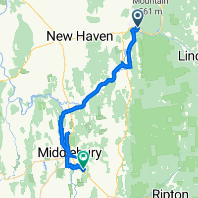
Overview
About this route
Natural Turnpike, Forest Road 2011, Cobb Hill, West Hill, back.
- -:--
- Duration
- 39.2 km
- Distance
- 700 m
- Ascent
- 698 m
- Descent
- ---
- Avg. speed
- ---
- Max. altitude
Continue with Bikemap
Use, edit, or download this cycling route
You would like to ride Mary Yates-Hills or customize it for your own trip? Here is what you can do with this Bikemap route:
Free features
- Save this route as favorite or in collections
- Copy & plan your own version of this route
- Sync your route with Garmin or Wahoo
Premium features
Free trial for 3 days, or one-time payment. More about Bikemap Premium.
- Navigate this route on iOS & Android
- Export a GPX / KML file of this route
- Create your custom printout (try it for free)
- Download this route for offline navigation
Discover more Premium features.
Get Bikemap PremiumFrom our community
Other popular routes starting in Bristol
 Vermont - Classic
- Distance
- 115.3 km
- Ascent
- 1,312 m
- Descent
- 1,318 m
- Location
- Bristol, Vermont, United States
 Bristol-LincolnGap-WestHill-AppGap
- Distance
- 58.9 km
- Ascent
- 1,218 m
- Descent
- 1,217 m
- Location
- Bristol, Vermont, United States
 03-MRB3 - AVRIL 2017
- Distance
- 80.8 km
- Ascent
- 789 m
- Descent
- 789 m
- Location
- Bristol, Vermont, United States
 02-MRB2 Avril 2017
- Distance
- 88.2 km
- Ascent
- 542 m
- Descent
- 542 m
- Location
- Bristol, Vermont, United States
 Cyclo-camping Pion-L-Giguere 06-2010 - jour5
- Distance
- 64.3 km
- Ascent
- 672 m
- Descent
- 859 m
- Location
- Bristol, Vermont, United States
 bobcat brewery to drop in brewing co - VT
- Distance
- 28.2 km
- Ascent
- 256 m
- Descent
- 308 m
- Location
- Bristol, Vermont, United States
 Mary Yates - Short
- Distance
- 21.6 km
- Ascent
- 422 m
- Descent
- 549 m
- Location
- Bristol, Vermont, United States
 GMSR RR - Classic Course
- Distance
- 103.5 km
- Ascent
- 1,336 m
- Descent
- 1,079 m
- Location
- Bristol, Vermont, United States
Open it in the app