

201408-01 Regentalradweg Bayerisch Eisenstein - Patersdorf
A cycling route starting in Železná Ruda, Plzeň Region, Czechia.
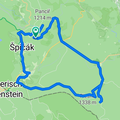
Overview
About this route
2014 Regentalradweg 01 Bayerisch Eisenstein - Patersdorf Bayerisch Eisenstein - Zwiesel - Regen - Patersdorf
- -:--
- Duration
- 45.9 km
- Distance
- 378 m
- Ascent
- 591 m
- Descent
- ---
- Avg. speed
- ---
- Max. altitude

Route quality
Waytypes & surfaces along the route
Waytypes
Quiet road
24.8 km
(54 %)
Track
7.3 km
(16 %)
Surfaces
Paved
21.1 km
(46 %)
Unpaved
8.7 km
(19 %)
Asphalt
19.7 km
(43 %)
Gravel
6.9 km
(15 %)
Continue with Bikemap
Use, edit, or download this cycling route
You would like to ride 201408-01 Regentalradweg Bayerisch Eisenstein - Patersdorf or customize it for your own trip? Here is what you can do with this Bikemap route:
Free features
- Save this route as favorite or in collections
- Copy & plan your own version of this route
- Sync your route with Garmin or Wahoo
Premium features
Free trial for 3 days, or one-time payment. More about Bikemap Premium.
- Navigate this route on iOS & Android
- Export a GPX / KML file of this route
- Create your custom printout (try it for free)
- Download this route for offline navigation
Discover more Premium features.
Get Bikemap PremiumFrom our community
Other popular routes starting in Železná Ruda
 Železná Ruda - Schwellhausel
- Distance
- 18.9 km
- Ascent
- 412 m
- Descent
- 412 m
- Location
- Železná Ruda, Plzeň Region, Czechia
 Šumava: Železná ruda - Horní planá
- Distance
- 177 km
- Ascent
- 1,774 m
- Descent
- 1,803 m
- Location
- Železná Ruda, Plzeň Region, Czechia
 2015.06.23 Šumava - 4 deň - jazero Laka
- Distance
- 37.9 km
- Ascent
- 872 m
- Descent
- 872 m
- Location
- Železná Ruda, Plzeň Region, Czechia
 Na jezera Laka
- Distance
- 43.9 km
- Ascent
- 691 m
- Descent
- 691 m
- Location
- Železná Ruda, Plzeň Region, Czechia
 MTB ŠUMAVSKÁ
- Distance
- 55.7 km
- Ascent
- 1,239 m
- Descent
- 1,239 m
- Location
- Železná Ruda, Plzeň Region, Czechia
 SpicakNovaHurka
- Distance
- 28.6 km
- Ascent
- 581 m
- Descent
- 618 m
- Location
- Železná Ruda, Plzeň Region, Czechia
 Špičák - Plzeň vol2
- Distance
- 94.8 km
- Ascent
- 490 m
- Descent
- 1,014 m
- Location
- Železná Ruda, Plzeň Region, Czechia
 Vrcholky Zeleznorudska
- Distance
- 76.4 km
- Ascent
- 2,040 m
- Descent
- 2,040 m
- Location
- Železná Ruda, Plzeň Region, Czechia
Open it in the app