

201405-02 Iller - Donau - Zusam Ulm - Hörvelsingen
A cycling route starting in Staig, Baden-Wurttemberg, Germany.
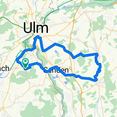
Overview
About this route
2014 Iller - Donau - Zusam 02 Ulm - Hörvelsingen
- -:--
- Duration
- 23.9 km
- Distance
- 167 m
- Ascent
- 146 m
- Descent
- ---
- Avg. speed
- ---
- Max. altitude

Route quality
Waytypes & surfaces along the route
Waytypes
Path
7.6 km
(32 %)
Cycleway
5.4 km
(23 %)
Surfaces
Paved
21.4 km
(90 %)
Unpaved
1.6 km
(7 %)
Asphalt
20 km
(84 %)
Paved (undefined)
1.3 km
(6 %)
Continue with Bikemap
Use, edit, or download this cycling route
You would like to ride 201405-02 Iller - Donau - Zusam Ulm - Hörvelsingen or customize it for your own trip? Here is what you can do with this Bikemap route:
Free features
- Save this route as favorite or in collections
- Copy & plan your own version of this route
- Sync your route with Garmin or Wahoo
Premium features
Free trial for 3 days, or one-time payment. More about Bikemap Premium.
- Navigate this route on iOS & Android
- Export a GPX / KML file of this route
- Create your custom printout (try it for free)
- Download this route for offline navigation
Discover more Premium features.
Get Bikemap PremiumFrom our community
Other popular routes starting in Staig
 Morgenrunde-Oberdischingen-Ringingen
- Distance
- 39.2 km
- Ascent
- 267 m
- Descent
- 268 m
- Location
- Staig, Baden-Wurttemberg, Germany
 Im Gässele 9, Ulm nach Im Gässele 7, Ulm
- Distance
- 39.8 km
- Ascent
- 182 m
- Descent
- 184 m
- Location
- Staig, Baden-Wurttemberg, Germany
 Wiblingen-rund um den Feedersee und zurück
- Distance
- 111.4 km
- Ascent
- 284 m
- Descent
- 287 m
- Location
- Staig, Baden-Wurttemberg, Germany
 Rundtour zum Blautopf und über Ulm zurück
- Distance
- 63.8 km
- Ascent
- 471 m
- Descent
- 473 m
- Location
- Staig, Baden-Wurttemberg, Germany
 04.05.2020
- Distance
- 18.8 km
- Ascent
- 134 m
- Descent
- 134 m
- Location
- Staig, Baden-Wurttemberg, Germany
 Feierabendrunde
- Distance
- 30.9 km
- Ascent
- 133 m
- Descent
- 133 m
- Location
- Staig, Baden-Wurttemberg, Germany
 HOLZH PFAFF WEISSENH
- Distance
- 52.5 km
- Ascent
- 148 m
- Descent
- 148 m
- Location
- Staig, Baden-Wurttemberg, Germany
 Wiblingen-Ochsenhausen über Ringschnait
- Distance
- 99.8 km
- Ascent
- 360 m
- Descent
- 368 m
- Location
- Staig, Baden-Wurttemberg, Germany
Open it in the app