

Fontainebleau-Orléans-Chartres 190km 410hm
A cycling route starting in Moret-sur-Loing, Île-de-France Region, France.
Overview
About this route
Southwestwards then northwestwards on a cathedral tour
- -:--
- Duration
- 190.1 km
- Distance
- 249 m
- Ascent
- 145 m
- Descent
- ---
- Avg. speed
- ---
- Max. altitude
Route quality
Waytypes & surfaces along the route
Waytypes
Road
24.7 km
(13 %)
Quiet road
22.8 km
(12 %)
Surfaces
Paved
74.1 km
(39 %)
Asphalt
74.1 km
(39 %)
Undefined
116 km
(61 %)
Continue with Bikemap
Use, edit, or download this cycling route
You would like to ride Fontainebleau-Orléans-Chartres 190km 410hm or customize it for your own trip? Here is what you can do with this Bikemap route:
Free features
- Save this route as favorite or in collections
- Copy & plan your own version of this route
- Split it into stages to create a multi-day tour
- Sync your route with Garmin or Wahoo
Premium features
Free trial for 3 days, or one-time payment. More about Bikemap Premium.
- Navigate this route on iOS & Android
- Export a GPX / KML file of this route
- Create your custom printout (try it for free)
- Download this route for offline navigation
Discover more Premium features.
Get Bikemap PremiumFrom our community
Other popular routes starting in Moret-sur-Loing
 Moret-Loing-et-Orvanne - Combreux
- Distance
- 88.1 km
- Ascent
- 370 m
- Descent
- 293 m
- Location
- Moret-sur-Loing, Île-de-France Region, France
 De Route de Saint-Mammès 18, Moret-Loing-et-Orvanne à Rue du Général de Ségur 119, Thomery
- Distance
- 9.5 km
- Ascent
- 72 m
- Descent
- 72 m
- Location
- Moret-sur-Loing, Île-de-France Region, France
 Fontainebleau-Orléans-Chartres 190km 410hm
- Distance
- 190.1 km
- Ascent
- 249 m
- Descent
- 145 m
- Location
- Moret-sur-Loing, Île-de-France Region, France
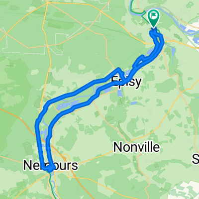
 Moret Nemours
- Distance
- 19.8 km
- Ascent
- 1,063 m
- Descent
- 1,118 m
- Location
- Moret-sur-Loing, Île-de-France Region, France
 Girolibero: Parigi e la Senna bici e barca
- Distance
- 237.9 km
- Ascent
- 342 m
- Descent
- 357 m
- Location
- Moret-sur-Loing, Île-de-France Region, France
 De 6 Rue de la Grange Taton, Moret-sur-Loing à 4 Rue de la Grange Taton, Moret-sur-Loing
- Distance
- 15.8 km
- Ascent
- 191 m
- Descent
- 197 m
- Location
- Moret-sur-Loing, Île-de-France Region, France
 De Paris à Tours à vélo par Nicolas : étape 6, Moret-sur-Loing-Nemours (2022)
- Distance
- 18.3 km
- Ascent
- 64 m
- Descent
- 52 m
- Location
- Moret-sur-Loing, Île-de-France Region, France
 moret s/ loing canal-Nemours-Grez-Montigny
- Distance
- 44.8 km
- Ascent
- 75 m
- Descent
- 75 m
- Location
- Moret-sur-Loing, Île-de-France Region, France
Open it in the app