

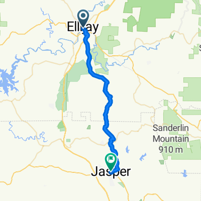
JASPER TO CHATSWORTH VIA HWY 52
A cycling route starting in Ellijay, Georgia, United States.
Overview
About this route
PARK AT THE ELEMENTARY SCHOOL IN JASPER.
STORE STOP IN CHASTWORH.- -:--
- Duration
- 77.2 km
- Distance
- 1,036 m
- Ascent
- 1,033 m
- Descent
- ---
- Avg. speed
- ---
- Max. altitude
Route quality
Waytypes & surfaces along the route
Waytypes
Busy road
45.1 km
(58 %)
Road
28.9 km
(37 %)
Surfaces
Paved
36.7 km
(47 %)
Unpaved
6.3 km
(8 %)
Asphalt
36.2 km
(47 %)
Gravel
6.3 km
(8 %)
Route highlights
Points of interest along the route
Point of interest after 37.5 km
STORE STOP-TURN AROUND
Continue with Bikemap
Use, edit, or download this cycling route
You would like to ride JASPER TO CHATSWORTH VIA HWY 52 or customize it for your own trip? Here is what you can do with this Bikemap route:
Free features
- Save this route as favorite or in collections
- Copy & plan your own version of this route
- Sync your route with Garmin or Wahoo
Premium features
Free trial for 3 days, or one-time payment. More about Bikemap Premium.
- Navigate this route on iOS & Android
- Export a GPX / KML file of this route
- Create your custom printout (try it for free)
- Download this route for offline navigation
Discover more Premium features.
Get Bikemap PremiumFrom our community
Other popular routes starting in Ellijay
 Ellijay Cycling
- Distance
- 20.4 km
- Ascent
- 476 m
- Descent
- 841 m
- Location
- Ellijay, Georgia, United States
 Sporty route
- Distance
- 48.9 km
- Ascent
- 641 m
- Descent
- 437 m
- Location
- Ellijay, Georgia, United States
 197 N Main St, Ellijay to 9131 SR-52, Ellijay
- Distance
- 15.9 km
- Ascent
- 311 m
- Descent
- 180 m
- Location
- Ellijay, Georgia, United States
 Restful route in Chatsworth
- Distance
- 6.5 km
- Ascent
- 398 m
- Descent
- 397 m
- Location
- Ellijay, Georgia, United States
 burnt mountain
- Distance
- 64.3 km
- Ascent
- 816 m
- Descent
- 816 m
- Location
- Ellijay, Georgia, United States
 From Ellijay to Jasper
- Distance
- 33.2 km
- Ascent
- 699 m
- Descent
- 643 m
- Location
- Ellijay, Georgia, United States
 JASPER TO CHATSWORTH VIA HWY 52
- Distance
- 77.2 km
- Ascent
- 1,036 m
- Descent
- 1,033 m
- Location
- Ellijay, Georgia, United States
 GA Pinhoti Trail
- Distance
- 217.6 km
- Ascent
- 1,900 m
- Descent
- 1,982 m
- Location
- Ellijay, Georgia, United States
Open it in the app