

Pirineos Spandelle-Aubisque
A cycling route starting in Argelès-Gazost, Occitanie, France.
Overview
About this route
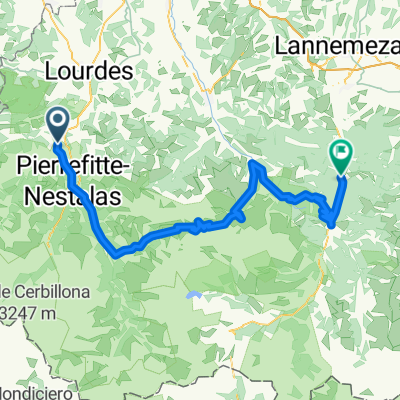
Spandelles-Soulor-Gourette-Aubisque-Argelès
- -:--
- Duration
- 79.2 km
- Distance
- 2,607 m
- Ascent
- 2,605 m
- Descent
- ---
- Avg. speed
- ---
- Max. altitude

Route quality
Waytypes & surfaces along the route
Waytypes
Quiet road
24.6 km
(31 %)
Road
1.6 km
(2 %)
Undefined
53.1 km
(67 %)
Surfaces
Paved
75.3 km
(95 %)
Asphalt
75.3 km
(95 %)
Undefined
4 km
(5 %)
Continue with Bikemap
Use, edit, or download this cycling route
You would like to ride Pirineos Spandelle-Aubisque or customize it for your own trip? Here is what you can do with this Bikemap route:
Free features
- Save this route as favorite or in collections
- Copy & plan your own version of this route
- Sync your route with Garmin or Wahoo
Premium features
Free trial for 3 days, or one-time payment. More about Bikemap Premium.
- Navigate this route on iOS & Android
- Export a GPX / KML file of this route
- Create your custom printout (try it for free)
- Download this route for offline navigation
Discover more Premium features.
Get Bikemap PremiumFrom our community
Other popular routes starting in Argelès-Gazost
 R4K PC2012 dag 3 Groep A
- Distance
- 125.7 km
- Ascent
- 2,408 m
- Descent
- 2,409 m
- Location
- Argelès-Gazost, Occitanie, France
 Pirenaica11. Agos-Vidalos - Luz-Saint-Sauveur
- Distance
- 121 km
- Ascent
- 3,391 m
- Descent
- 3,074 m
- Location
- Argelès-Gazost, Occitanie, France
 R4K PC2012 Dag 1 middag
- Distance
- 37.4 km
- Ascent
- 1,245 m
- Descent
- 1,244 m
- Location
- Argelès-Gazost, Occitanie, France
 Aubisque
- Distance
- 29.1 km
- Ascent
- 1,533 m
- Descent
- 273 m
- Location
- Argelès-Gazost, Occitanie, France
 Pirineos Spandelle-Aubisque
- Distance
- 79.2 km
- Ascent
- 2,607 m
- Descent
- 2,605 m
- Location
- Argelès-Gazost, Occitanie, France
 V13 Col de Couraduque
- Distance
- 16.3 km
- Ascent
- 963 m
- Descent
- 40 m
- Location
- Argelès-Gazost, Occitanie, France
 HPSV E6 9sep.
- Distance
- 86.2 km
- Ascent
- 2,322 m
- Descent
- 2,128 m
- Location
- Argelès-Gazost, Occitanie, France
 Argeles-Gazost- Lanus
- Distance
- 114.3 km
- Ascent
- 3,302 m
- Descent
- 3,296 m
- Location
- Argelès-Gazost, Occitanie, France
Open it in the app