

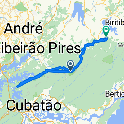
CAMINHO DO SAL (Mogi das Cruzes, Paranapiacaba, Riacho Grande)
- 68.2 km
- 494 m
- 522 m
- Rio Grande da Serra, São Paulo, Brazil
A cycling route starting in Rio Grande da Serra, São Paulo, Brazil.
Overview
Caminho do Sal (Mogi das Cruzes to Riacho Grande via Paranapiacaba). July 2014 (cloned from route 2709249)
created this 11 years ago
Route quality
Quiet road
36.2 km
(53 %)
Road
25.3 km
(37 %)
Undefined
6.8 km
(10 %)
Paved
18.4 km
(27 %)
Unpaved
48.5 km
(71 %)
Ground
28.7 km
(42 %)
Unpaved (undefined)
19.8 km
(29 %)
Continue with Bikemap
You would like to ride CAMINHO DO SAL (Mogi das Cruzes, Paranapiacaba, Riacho Grande) or customize it for your own trip? Here is what you can do with this Bikemap route:
Free trial for 3 days, or one-time payment. More about Bikemap Premium.
Discover more Premium features.
Get Bikemap PremiumFrom our community
Open it in the app


