

Seentour
A cycling route starting in Steinfurt, North Rhine-Westphalia, Germany.
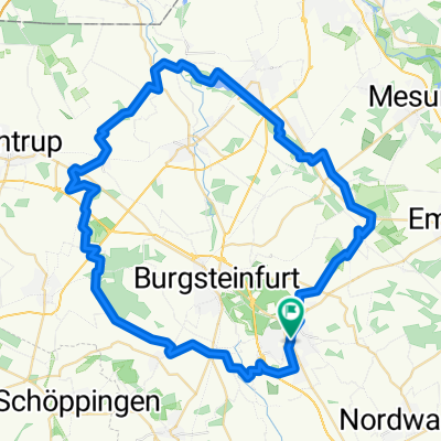
Overview
About this route
Gundlagen Tour an vielen kleinen Teichen, Seen, Bächen und Flüssen entlang. Hoher Offroadanteil, nette Singletrails und wenig Verkehr.
- -:--
- Duration
- 54.6 km
- Distance
- 141 m
- Ascent
- 161 m
- Descent
- ---
- Avg. speed
- 95 m
- Max. altitude

Route quality
Waytypes & surfaces along the route
Waytypes
Path
28 km
(51 %)
Quiet road
13.1 km
(24 %)
Surfaces
Paved
14.2 km
(26 %)
Unpaved
27.8 km
(51 %)
Ground
15 km
(27 %)
Asphalt
11 km
(20 %)
Continue with Bikemap
Use, edit, or download this cycling route
You would like to ride Seentour or customize it for your own trip? Here is what you can do with this Bikemap route:
Free features
- Save this route as favorite or in collections
- Copy & plan your own version of this route
- Sync your route with Garmin or Wahoo
Premium features
Free trial for 3 days, or one-time payment. More about Bikemap Premium.
- Navigate this route on iOS & Android
- Export a GPX / KML file of this route
- Create your custom printout (try it for free)
- Download this route for offline navigation
Discover more Premium features.
Get Bikemap PremiumFrom our community
Other popular routes starting in Steinfurt
 Steinfurt_Wasserschlösser
- Distance
- 43.6 km
- Ascent
- 128 m
- Descent
- 125 m
- Location
- Steinfurt, North Rhine-Westphalia, Germany
 CE120225
- Distance
- 25.4 km
- Ascent
- 129 m
- Descent
- 132 m
- Location
- Steinfurt, North Rhine-Westphalia, Germany
 Steinfurt, Rheine, Elte Emsdetten Steinfurt
- Distance
- 56.8 km
- Ascent
- 102 m
- Descent
- 108 m
- Location
- Steinfurt, North Rhine-Westphalia, Germany
 awv Steinfurt C+A nach Rheine City
- Distance
- 19.6 km
- Ascent
- 23 m
- Descent
- 51 m
- Location
- Steinfurt, North Rhine-Westphalia, Germany
 Auf X Rad- und Wanderwegen rund Steinfurt
- Distance
- 59.2 km
- Ascent
- 102 m
- Descent
- 102 m
- Location
- Steinfurt, North Rhine-Westphalia, Germany
 Sellen
- Distance
- 19 km
- Ascent
- 56 m
- Descent
- 56 m
- Location
- Steinfurt, North Rhine-Westphalia, Germany
 2009 11 22 Borghorst - Bagno/B54n/MetelenLand/Dumte
- Distance
- 31.9 km
- Ascent
- 80 m
- Descent
- 80 m
- Location
- Steinfurt, North Rhine-Westphalia, Germany
 Über den Schöppinger Berg
- Distance
- 36.4 km
- Ascent
- 176 m
- Descent
- 176 m
- Location
- Steinfurt, North Rhine-Westphalia, Germany
Open it in the app