

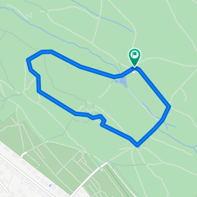
Rennvelotour - Zürich, Greifensee und Umland
A cycling route starting in Zürich (Kreis 6) / Oberstrass, Canton of Zurich, Switzerland.
Overview
About this route
Approximate travel time is 3h to 3:15 h on a racing bike. Not necessarily suitable for children and untrained individuals.
- -:--
- Duration
- 83.3 km
- Distance
- 816 m
- Ascent
- 818 m
- Descent
- ---
- Avg. speed
- ---
- Max. altitude
Route quality
Waytypes & surfaces along the route
Waytypes
Quiet road
22.5 km
(27 %)
Path
21.7 km
(26 %)
Surfaces
Paved
78.3 km
(94 %)
Unpaved
1.7 km
(2 %)
Asphalt
77.5 km
(93 %)
Gravel
1.7 km
(2 %)
Continue with Bikemap
Use, edit, or download this cycling route
You would like to ride Rennvelotour - Zürich, Greifensee und Umland or customize it for your own trip? Here is what you can do with this Bikemap route:
Free features
- Save this route as favorite or in collections
- Copy & plan your own version of this route
- Split it into stages to create a multi-day tour
- Sync your route with Garmin or Wahoo
Premium features
Free trial for 3 days, or one-time payment. More about Bikemap Premium.
- Navigate this route on iOS & Android
- Export a GPX / KML file of this route
- Create your custom printout (try it for free)
- Download this route for offline navigation
Discover more Premium features.
Get Bikemap PremiumFrom our community
Other popular routes starting in Zürich (Kreis 6) / Oberstrass
 Ausfahrt durch Zürich
- Distance
- 15.6 km
- Ascent
- 283 m
- Descent
- 311 m
- Location
- Zürich (Kreis 6) / Oberstrass, Canton of Zurich, Switzerland
 Day 1 - Zurich to Walenstadt
- Distance
- 85.9 km
- Ascent
- 194 m
- Descent
- 226 m
- Location
- Zürich (Kreis 6) / Oberstrass, Canton of Zurich, Switzerland
 Lakes Route - Zurich to Lausanne
- Distance
- 341.3 km
- Ascent
- 5,957 m
- Descent
- 5,992 m
- Location
- Zürich (Kreis 6) / Oberstrass, Canton of Zurich, Switzerland
 Giro ASVZ
- Distance
- 88.9 km
- Ascent
- 898 m
- Descent
- 898 m
- Location
- Zürich (Kreis 6) / Oberstrass, Canton of Zurich, Switzerland
 Bike-Parcour
- Distance
- 1.4 km
- Ascent
- 39 m
- Descent
- 39 m
- Location
- Zürich (Kreis 6) / Oberstrass, Canton of Zurich, Switzerland
 ASVZ-Runde Mont Sonnenbüel
- Distance
- 63.6 km
- Ascent
- 696 m
- Descent
- 753 m
- Location
- Zürich (Kreis 6) / Oberstrass, Canton of Zurich, Switzerland
 ASVZ Donnerstagsrunde
- Distance
- 45.9 km
- Ascent
- 455 m
- Descent
- 526 m
- Location
- Zürich (Kreis 6) / Oberstrass, Canton of Zurich, Switzerland
 Rennvelotour - Zürich, Greifensee und Umland
- Distance
- 83.3 km
- Ascent
- 816 m
- Descent
- 818 m
- Location
- Zürich (Kreis 6) / Oberstrass, Canton of Zurich, Switzerland
Open it in the app