

Poblets empordà
A cycling route starting in Torroella de Montgrí, Catalonia, Spain.
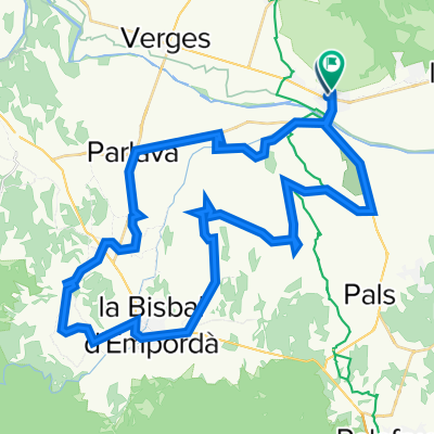
Overview
About this route
Dia 1
- -:--
- Duration
- 52.9 km
- Distance
- 271 m
- Ascent
- 269 m
- Descent
- ---
- Avg. speed
- ---
- Max. altitude
Route quality
Waytypes & surfaces along the route
Waytypes
Quiet road
23.1 km
(44 %)
Busy road
16.3 km
(31 %)
Surfaces
Paved
22.2 km
(42 %)
Unpaved
0.8 km
(2 %)
Asphalt
22.2 km
(42 %)
Unpaved (undefined)
0.5 km
(<1 %)
Route highlights
Points of interest along the route
Point of interest after 15.2 km
Poblet de 180 habitants.
Point of interest after 18.3 km
Poblet amb una forta empremta romana.
Point of interest after 21.2 km
poble contruiït al voltant d'una antiga muralla medieval. En aquella època el mercat medieval de Monells fou molt important.
Point of interest after 25.2 km
cruïlles 76 m elevació
Point of interest after 28.3 km
especialistes amb ceràmica, castell d'estil romànic.
Point of interest after 35.6 km
poblat ibèric ullastret
Continue with Bikemap
Use, edit, or download this cycling route
You would like to ride Poblets empordà or customize it for your own trip? Here is what you can do with this Bikemap route:
Free features
- Save this route as favorite or in collections
- Copy & plan your own version of this route
- Sync your route with Garmin or Wahoo
Premium features
Free trial for 3 days, or one-time payment. More about Bikemap Premium.
- Navigate this route on iOS & Android
- Export a GPX / KML file of this route
- Create your custom printout (try it for free)
- Download this route for offline navigation
Discover more Premium features.
Get Bikemap PremiumFrom our community
Other popular routes starting in Torroella de Montgrí
 emporda 50km
- Distance
- 52.7 km
- Ascent
- 248 m
- Descent
- 239 m
- Location
- Torroella de Montgrí, Catalonia, Spain
 Estartit, dunes, Puig segalar, Dunes, Rocamoura Estartit
- Distance
- 50.4 km
- Ascent
- 503 m
- Descent
- 503 m
- Location
- Torroella de Montgrí, Catalonia, Spain
 17 augustus
- Distance
- 64.3 km
- Ascent
- 495 m
- Descent
- 492 m
- Location
- Torroella de Montgrí, Catalonia, Spain
 Relaxed route in
- Distance
- 24.6 km
- Ascent
- 388 m
- Descent
- 418 m
- Location
- Torroella de Montgrí, Catalonia, Spain
 Estartit-dunes-cala Montgo- Albons-pic segalar -Estartit
- Distance
- 59 km
- Ascent
- 447 m
- Descent
- 447 m
- Location
- Torroella de Montgrí, Catalonia, Spain
 rando round
- Distance
- 1.8 km
- Ascent
- 39 m
- Descent
- 36 m
- Location
- Torroella de Montgrí, Catalonia, Spain
 emporda 50km
- Distance
- 52.8 km
- Ascent
- 248 m
- Descent
- 239 m
- Location
- Torroella de Montgrí, Catalonia, Spain
 Torroella de Montgrí-Verges-Bellcaire-Torroella
- Distance
- 24.6 km
- Ascent
- 102 m
- Descent
- 102 m
- Location
- Torroella de Montgrí, Catalonia, Spain
Open it in the app