

Silvretta-Arlbeg-Runde
A cycling route starting in Bartholomäberg, Vorarlberg, Austria.
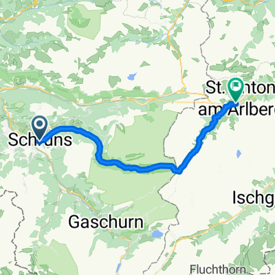
Overview
About this route
from Schruns via the Kops reservoir (turnoff at the 1st hairpin after the toll station in Partenen)
-
very steep climb from Partenen (1050 m) to Kops (1850 m) over 7 km
-
partly no asphalt, only gravel track
- -:--
- Duration
- 136.5 km
- Distance
- 2,220 m
- Ascent
- 2,220 m
- Descent
- ---
- Avg. speed
- ---
- Max. altitude

Continue with Bikemap
Use, edit, or download this cycling route
You would like to ride Silvretta-Arlbeg-Runde or customize it for your own trip? Here is what you can do with this Bikemap route:
Free features
- Save this route as favorite or in collections
- Copy & plan your own version of this route
- Split it into stages to create a multi-day tour
- Sync your route with Garmin or Wahoo
Premium features
Free trial for 3 days, or one-time payment. More about Bikemap Premium.
- Navigate this route on iOS & Android
- Export a GPX / KML file of this route
- Create your custom printout (try it for free)
- Download this route for offline navigation
Discover more Premium features.
Get Bikemap PremiumFrom our community
Other popular routes starting in Bartholomäberg
 Bartholomähberg, Kristberg
- Distance
- 17.4 km
- Ascent
- 558 m
- Descent
- 558 m
- Location
- Bartholomäberg, Vorarlberg, Austria
 Schruns, Silbertalrunde
- Distance
- 29.3 km
- Ascent
- 870 m
- Descent
- 887 m
- Location
- Bartholomäberg, Vorarlberg, Austria
 Silvretta-Arlbeg-Runde
- Distance
- 136.5 km
- Ascent
- 2,218 m
- Descent
- 2,218 m
- Location
- Bartholomäberg, Vorarlberg, Austria
 Silvretta-Arlbeg-Runde
- Distance
- 136.5 km
- Ascent
- 2,220 m
- Descent
- 2,220 m
- Location
- Bartholomäberg, Vorarlberg, Austria
 Zeinisjoch
- Distance
- 61.6 km
- Ascent
- 1,652 m
- Descent
- 1,291 m
- Location
- Bartholomäberg, Vorarlberg, Austria
 Übersgebirgradln 6: Schruns - Silbertal - St. Anton
- Distance
- 37.4 km
- Ascent
- 1,496 m
- Descent
- 731 m
- Location
- Bartholomäberg, Vorarlberg, Austria
 Bartholomäber - Itonskopf - Schruns
- Distance
- 22.6 km
- Ascent
- 871 m
- Descent
- 1,276 m
- Location
- Bartholomäberg, Vorarlberg, Austria
 Kristberg - Silbertal
- Distance
- 31.5 km
- Ascent
- 906 m
- Descent
- 903 m
- Location
- Bartholomäberg, Vorarlberg, Austria
Open it in the app