
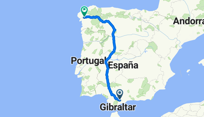
Ronda-Camino Santiago
A cycling route starting in Ronda, Andalusia, Spain.
Overview
About this route
Ronda hasta la catedral de Santiago
- -:--
- Duration
- 1,087.7 km
- Distance
- 3,418 m
- Ascent
- 3,893 m
- Descent
- ---
- Avg. speed
- ---
- Max. altitude

Continue with Bikemap
Use, edit, or download this cycling route
You would like to ride Ronda-Camino Santiago or customize it for your own trip? Here is what you can do with this Bikemap route:
Free features
- Save this route as favorite or in collections
- Copy & plan your own version of this route
- Split it into stages to create a multi-day tour
- Sync your route with Garmin or Wahoo
Premium features
Free trial for 3 days, or one-time payment. More about Bikemap Premium.
- Navigate this route on iOS & Android
- Export a GPX / KML file of this route
- Create your custom printout (try it for free)
- Download this route for offline navigation
Discover more Premium features.
Get Bikemap PremiumFrom our community
Other popular routes starting in Ronda
 Rennrad Ronda
- Distance
- 87.4 km
- Ascent
- 1,610 m
- Descent
- 1,610 m
- Location
- Ronda, Andalusia, Spain
 101 Km Ronda 2008-GR163
- Distance
- 102.7 km
- Ascent
- 1,395 m
- Descent
- 1,395 m
- Location
- Ronda, Andalusia, Spain
 Prueba Pilar de Coca
- Distance
- 16.4 km
- Ascent
- 154 m
- Descent
- 152 m
- Location
- Ronda, Andalusia, Spain
 Ronda MTB 40km
- Distance
- 38.2 km
- Ascent
- 497 m
- Descent
- 496 m
- Location
- Ronda, Andalusia, Spain
 J2 - Transandalousie (88km 1520D+)
- Distance
- 88 km
- Ascent
- 1,027 m
- Descent
- 1,254 m
- Location
- Ronda, Andalusia, Spain
 seguimiento 101
- Distance
- 60.7 km
- Ascent
- 765 m
- Descent
- 790 m
- Location
- Ronda, Andalusia, Spain
 Ronda-Grazalema-Zahara-Ronda
- Distance
- 83 km
- Ascent
- 1,470 m
- Descent
- 1,469 m
- Location
- Ronda, Andalusia, Spain
 Ronda-Setenil
- Distance
- 64.3 km
- Ascent
- 843 m
- Descent
- 839 m
- Location
- Ronda, Andalusia, Spain
Open it in the app