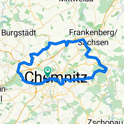
Chemnitz - Waldhof Gelenau und zurück
A cycling route starting in Chemnitz, Saxony, Germany.
Overview
About this route
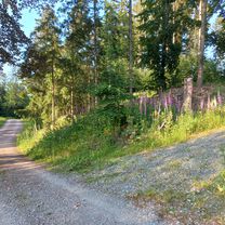
Richtige Gebirgslandschaft so nah an Chemnitz!
- -:--
- Duration
- 55.4 km
- Distance
- 559 m
- Ascent
- 563 m
- Descent
- ---
- Avg. speed
- ---
- Max. altitude
Route quality
Waytypes & surfaces along the route
Waytypes
Quiet road
18.3 km
(33 %)
Road
9.4 km
(17 %)
Surfaces
Paved
39.3 km
(71 %)
Unpaved
8.9 km
(16 %)
Asphalt
38.2 km
(69 %)
Gravel
5 km
(9 %)
Route highlights
Points of interest along the route
Point of interest after 18.1 km
Hinfahrt: abzweigen zum Waldhof Rückfahrt: Abzweigen gleich nach der Kirche Richtung Gewerbegebiet und B180
Point of interest after 27.1 km
Der schmale Weg an der Zschopau zweigt dort ab, wo zum ersten mal die Leitplanken an der Talseite unterbrochen sind. Man sieht dann durch die Bäume ein Verkehrszeichen und die Eisenbahnbrücke. Vorsicht, am Anfang ist es recht holprig und steil!
Point of interest after 28.2 km
Hier einen ganz, ganz schmalen Wiesenpfad nach schräg nach rechts (bevor die Straße bergab geht) nehmen. Man sieht dann gleich die Fußgängerbrücke, die an die Bahnbrücke angebaut ist.Da rüber!
Point of interest after 35 km
Hinfahrt: Richtung Weißbach und dann abzweigen zum Waldhof Rückfahrt: Gerade nach Weißbach und dann an der Kirche nach rechts abbiegen.
Point of interest after 38 km
Strecke ist recht holprig. Glatt geht es besser den Radweg entlang nach Norden bis und durch Dittersdorf.
Continue with Bikemap
Use, edit, or download this cycling route
You would like to ride Chemnitz - Waldhof Gelenau und zurück or customize it for your own trip? Here is what you can do with this Bikemap route:
Free features
- Save this route as favorite or in collections
- Copy & plan your own version of this route
- Sync your route with Garmin or Wahoo
Premium features
Free trial for 3 days, or one-time payment. More about Bikemap Premium.
- Navigate this route on iOS & Android
- Export a GPX / KML file of this route
- Create your custom printout (try it for free)
- Download this route for offline navigation
Discover more Premium features.
Get Bikemap PremiumFrom our community
Other popular routes starting in Chemnitz
 Jahnsdorfer-Klaffenbacher-Runde
- Distance
- 43.3 km
- Ascent
- 479 m
- Descent
- 480 m
- Location
- Chemnitz, Saxony, Germany
 Chemnitz Nord
- Distance
- 58.6 km
- Ascent
- 397 m
- Descent
- 383 m
- Location
- Chemnitz, Saxony, Germany
 Zwnönitzthal :-)
- Distance
- 38.2 km
- Ascent
- 474 m
- Descent
- 474 m
- Location
- Chemnitz, Saxony, Germany
 Monopfade Guste
- Distance
- 48.3 km
- Ascent
- 661 m
- Descent
- 680 m
- Location
- Chemnitz, Saxony, Germany
 Chemnitzer Stadtring
- Distance
- 30.4 km
- Ascent
- 259 m
- Descent
- 259 m
- Location
- Chemnitz, Saxony, Germany
 Abendrunde I
- Distance
- 30.6 km
- Ascent
- 218 m
- Descent
- 218 m
- Location
- Chemnitz, Saxony, Germany
 Chemnitz NordWest
- Distance
- 85.6 km
- Ascent
- 474 m
- Descent
- 474 m
- Location
- Chemnitz, Saxony, Germany
 Chemnitz - Fichtelberg Var1
- Distance
- 138 km
- Ascent
- 1,372 m
- Descent
- 1,375 m
- Location
- Chemnitz, Saxony, Germany
Open it in the app

