

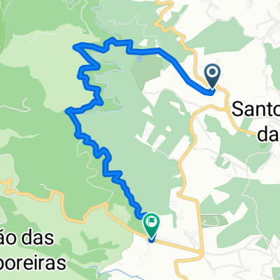
Santagro-Santo
A cycling route starting in Camacha, Madeira, Portugal.
Overview
About this route
.
- -:--
- Duration
- 5.8 km
- Distance
- 393 m
- Ascent
- 272 m
- Descent
- ---
- Avg. speed
- ---
- Max. altitude
Route highlights
Points of interest along the route
Point of interest after 5.8 km
Shakira
Continue with Bikemap
Use, edit, or download this cycling route
You would like to ride Santagro-Santo or customize it for your own trip? Here is what you can do with this Bikemap route:
Free features
- Save this route as favorite or in collections
- Copy & plan your own version of this route
- Sync your route with Garmin or Wahoo
Premium features
Free trial for 3 days, or one-time payment. More about Bikemap Premium.
- Navigate this route on iOS & Android
- Export a GPX / KML file of this route
- Create your custom printout (try it for free)
- Download this route for offline navigation
Discover more Premium features.
Get Bikemap PremiumFrom our community
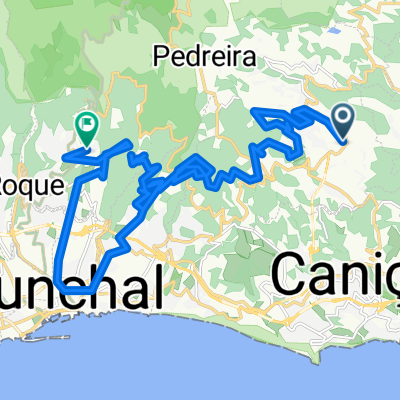
Other popular routes starting in Camacha
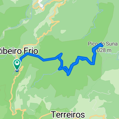
 ribeiro frio a furado
- Distance
- 11.1 km
- Ascent
- 743 m
- Descent
- 743 m
- Location
- Camacha, Madeira, Portugal
 Kurze Ausfahrt vom 23.11.16, 13:59
- Distance
- 5.2 km
- Ascent
- 324 m
- Descent
- 587 m
- Location
- Camacha, Madeira, Portugal
 Santagro-Santo
- Distance
- 5.8 km
- Ascent
- 393 m
- Descent
- 272 m
- Location
- Camacha, Madeira, Portugal
 B01 Camacha Porto Da Cruz
- Distance
- 21.3 km
- Ascent
- 512 m
- Descent
- 1,213 m
- Location
- Camacha, Madeira, Portugal
 De Portugal a Portugal
- Distance
- 31 km
- Ascent
- 236 m
- Descent
- 243 m
- Location
- Camacha, Madeira, Portugal
 Vereda da Achadinha nach Largo da Fonte
- Distance
- 33.7 km
- Ascent
- 2,482 m
- Descent
- 2,608 m
- Location
- Camacha, Madeira, Portugal
 De Portugal a Escola do Rochão, Camacha
- Distance
- 3 km
- Ascent
- 0 m
- Descent
- 17 m
- Location
- Camacha, Madeira, Portugal
 20170621_114550.gpx
- Distance
- 19.6 km
- Ascent
- 682 m
- Descent
- 682 m
- Location
- Camacha, Madeira, Portugal
Open it in the app