

Nettetal Radweg
A cycling route starting in Mönchengladbach, North Rhine-Westphalia, Germany.
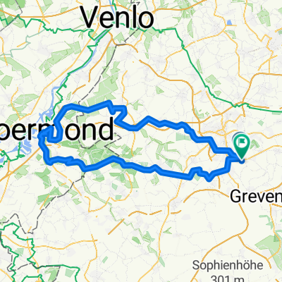
Overview
About this route
Nettetal liegt im Herzen des Naturschutzgebietes Maas-Schwalm-Nette am Flüsschen Nette. Die Rad-Strecken ist geprägt von ihrer wasser- und naturreichen Umgebung, und wird daher auch Radwanderung der Seen genannt. Alleine 12 Seen, sowie ausgedehnte Wälder und Heidelandschaften in und rund um Nettetal.
- -:--
- Duration
- 65.6 km
- Distance
- 111 m
- Ascent
- 111 m
- Descent
- ---
- Avg. speed
- ---
- Max. altitude

Route quality
Waytypes & surfaces along the route
Waytypes
Quiet road
31.3 km
(48 %)
Path
15.4 km
(23 %)
Surfaces
Paved
36.4 km
(56 %)
Unpaved
10.7 km
(16 %)
Asphalt
32.1 km
(49 %)
Gravel
5.5 km
(8 %)
Route highlights
Points of interest along the route

Accommodation after 28.7 km
Hotel & Restaurant Am Krickenbecker See Krickenbecker Allee 38 41334 Nettetal Telefon 02153 2609

Accommodation after 31.8 km
Restaurant Birkenhof Heerstraße 60 D-41334 Nettetal Fon 0049 - (0) 2157 / 4305 Küche ab 11:30 Uhr

Photo after 35.3 km
Rohrdommel-Projekt, Das auf vier Jahre angelegte Projekt an der Nette ist nahezu beendet. Für die Biologen ist die Umwandlung eines öden Waldes in eine von Schilf gesäumte Wasserfläche ein Erfolg. Viele seltene Vögel haben das Gebiet erobert

Accommodation after 36.2 km
Cafe Restaurant De Wittsee Am Wittsee 25A, 41334 Nettetal Telefon:02157 1385616 Öffnungszeiten Geöffnet von 12 - 21 Uhr Sonn- und Feiertags von 11 - 21 Uhr
Continue with Bikemap
Use, edit, or download this cycling route
You would like to ride Nettetal Radweg or customize it for your own trip? Here is what you can do with this Bikemap route:
Free features
- Save this route as favorite or in collections
- Copy & plan your own version of this route
- Sync your route with Garmin or Wahoo
Premium features
Free trial for 3 days, or one-time payment. More about Bikemap Premium.
- Navigate this route on iOS & Android
- Export a GPX / KML file of this route
- Create your custom printout (try it for free)
- Download this route for offline navigation
Discover more Premium features.
Get Bikemap PremiumFrom our community
Other popular routes starting in Mönchengladbach
 Von Rheydt zum Adolfosee bei Hückelhoven an der Rur
- Distance
- 58.6 km
- Ascent
- 118 m
- Descent
- 118 m
- Location
- Mönchengladbach, North Rhine-Westphalia, Germany
 Zigarren holen in Holland
- Distance
- 106.1 km
- Ascent
- 204 m
- Descent
- 186 m
- Location
- Mönchengladbach, North Rhine-Westphalia, Germany
 Feierabendrunde Mönchengladbach
- Distance
- 25.6 km
- Ascent
- 51 m
- Descent
- 55 m
- Location
- Mönchengladbach, North Rhine-Westphalia, Germany
 Mönchengladbach
- Distance
- 39.3 km
- Ascent
- 113 m
- Descent
- 113 m
- Location
- Mönchengladbach, North Rhine-Westphalia, Germany
 Venn-Holtmühle-Tüschenbroich-Venn
- Distance
- 41.5 km
- Ascent
- 85 m
- Descent
- 83 m
- Location
- Mönchengladbach, North Rhine-Westphalia, Germany
 Schöne Rennradstrecke(de Meinweg)
- Distance
- 74.4 km
- Ascent
- 197 m
- Descent
- 177 m
- Location
- Mönchengladbach, North Rhine-Westphalia, Germany
 Morgenrunde
- Distance
- 35 km
- Ascent
- 91 m
- Descent
- 94 m
- Location
- Mönchengladbach, North Rhine-Westphalia, Germany
 Abendrunde
- Distance
- 30.4 km
- Ascent
- 38 m
- Descent
- 36 m
- Location
- Mönchengladbach, North Rhine-Westphalia, Germany
Open it in the app